

If you would like to select a site directly and explore what else is in this state, please select a location marker above.
If you would like to explore what is in individual counties, please select your county of interest above.
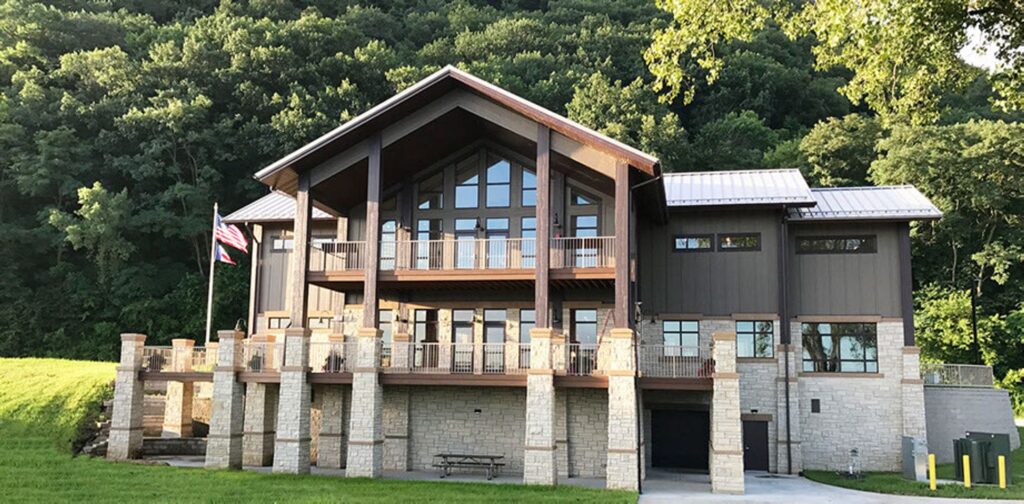
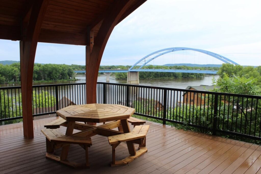
Driftless Area Education and Visitor Center
Coordinates: 43.34695921700323° N, -91.20326328277588° W
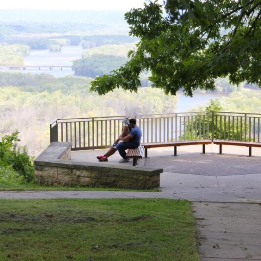
The Driftless Area Education and Visitor Center is located just south of the town of Lansing in the shadow of the region’s characteristic limestone bluffs and at the confluence of Village Creek and the Mississippi River. It is the only visitor center for the Driftless Area and the Driftless Area Scenic Byway and a priority stop for visitors along the Great River Road National Scenic Byway. Visitors can learn about the unique geology and karst topography of the Driftless Area, come face to face with local wildlife, and learn about the rich history of the area at this visitor center. The large windows and expansive decks also provide beautiful views of the Upper Mississippi River Fish and Wildlife Refuge.
Any fees?: No, it’s free!
Dog Friendly?: Yes (on the grounds); No (inside buildings)
Time to Complete: 1-2 hours
Managed by: Allamakee County Conservation Board
More Info:
Coldwater Cave State Preserve
Located 3 miles northwest of Bluffton off of Coldwater Creek Road
Coordinates: 43.43432199496354° N, -91.94785837761273° W
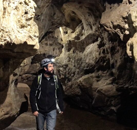
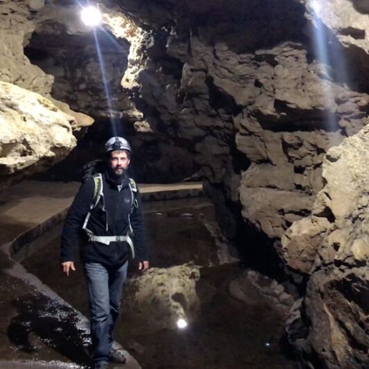
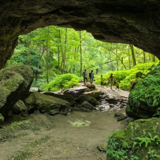
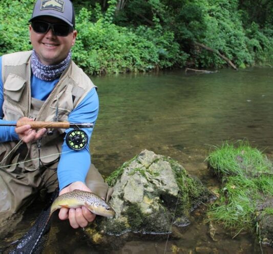
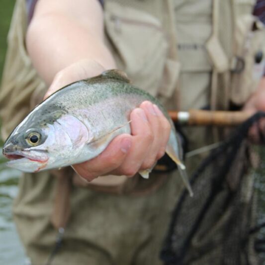
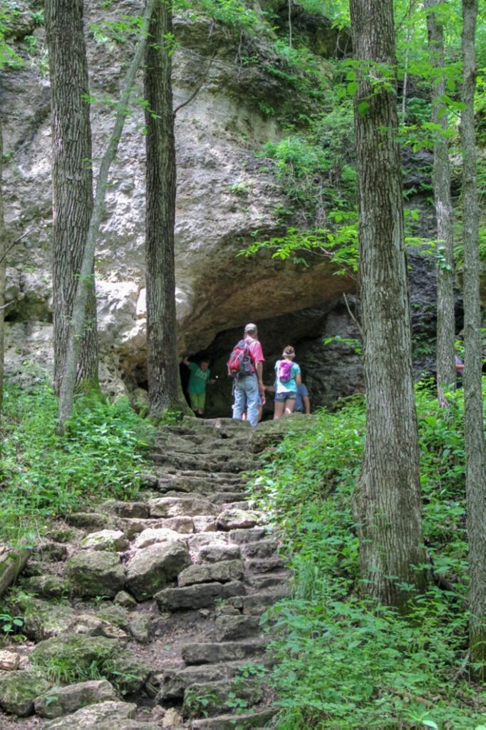
Coldwater Cave State Preserve is a 60-acre public area. It encompasses Coldwater Spring, which bubbles out of Coldwater Cave, one of the most extensive karst cave systems in the Driftless Area. It also encompasses four miles of Coldwater Creek, which is one of several coldwater trout stream tributaries to the Upper Iowa River that is open to public fishing. Coldwater Cave, Iowa’s longest and most spectacular cave, is located beneath the gently rolling hills of farm country north of the State Preserve in Northeast Iowa and Southeast Minnesota. Considered as the most significant cave system of the Upper Midwest karst region, Coldwater Cave was designated a National Natural Landmark by the U.S. Department of the Interior in 1987. This status is accorded to geologic and ecological features considered to be of national significance. Since its discovery in the late sixties, over 20 miles of passages have been documented. The cave system, which is relatively young and still forming, is part of a fluvio-karst drainage basin located in northeast Winneshiek County, Iowa and southeast Fillmore County, Minnesota. The cave proper is situated in the Iowa part of that basin. Formed almost entirely within the Dunleith Formation of the Galena Group (Ordovician), the cave consists of over four miles of borehole and stream gallery, nearly a mile of parallel stream passage and another 11 miles of infeeders and their associated offshoots. The cave system, which is dendritic in its layout, is developed within a subtle carbonate ridge bounded by surface drainages; some of the side passages cross under these drainages. The entire area is mantled with loess and glacial till. There is only one natural entrance to the cave. It is the water-filled spring that issues from the base of a 150 foot-tall bluff located within the Coldwater Cave State Preserve. Visitors can hike along a designated path to see this entrance, but this underwater entrance is currently gated. This cave is NOT open to tourists. Due to extremely difficult access, fluctuating water levels, and risk of injury, only a few experienced adult cavers are granted limited, guided access.
Any fees?: No, it’s free!
Dog Friendly?: Yes
Time to Complete: 2 hours
Managed by: The Iowa Department of Natural Resources
More Info:
https://www.iowadnr.gov/idnr/Fishing/Where-to-Fish/Trout-Streams/Stream-Details?lakeCode=TCO96
Driftless Area Scenic Byway – Iowa
Coordinates: 43.088603432521175° N, -91.5685312758952° W
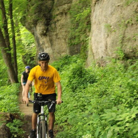
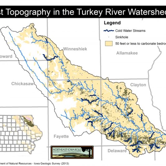
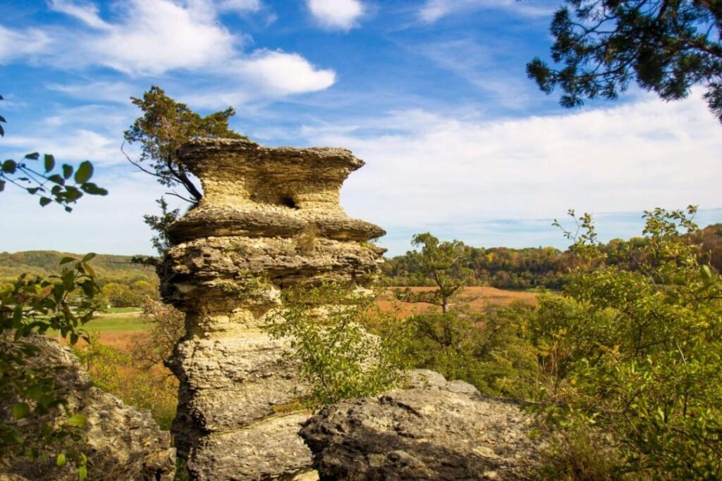
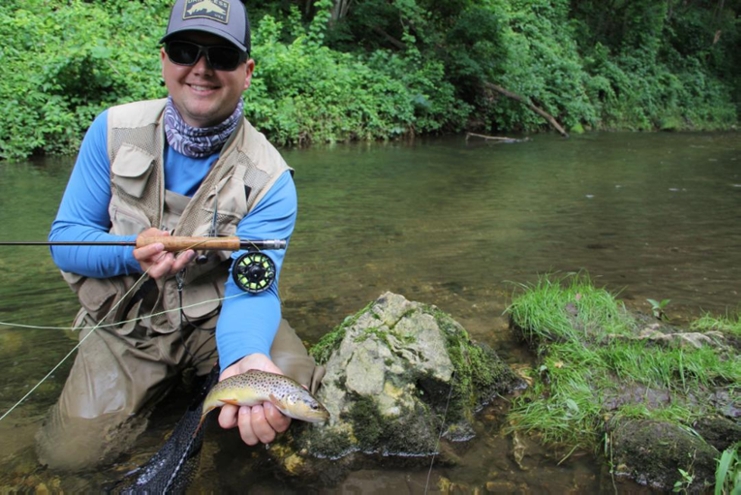
The Driftless Area Scenic Byway weaves through Winneshiek and Allamakee Counties. The sites in this Discovery Area are located within the “corridor” of the byway, which includes all of Allamakee County and a large portion of Winneshiek County. Northeast Iowa Karst topography dominates the Driftless Area Scenic Byway (DASB) Corridor. The rugged terrain is well developed with caves, sinkholes, springs, cold water trout streams, exposed bedrock, and steep, highly erodible slopes. The natural resources include the most popular cold water trout streams in the Midwest, one of the highest concentrations of threatened and endangered species in Iowa, a Globally Important Birding Area, and one of the greatest bird flyways in the world. They also include the only national monument in Iowa and one of only four major state forests. The DASB route meanders adjacent to rivers that are nationally recognized for their natural resources, including the Upper Mississippi River (Pool 9), the Yellow River, which is Iowa’s longest and largest cold water trout stream, and the Upper Iowa River, which was the only river in Iowa and one of the first in the nation to be nominated for inclusion into the National Wild and Scenic River Program.
Managed by: Northeast Iowa Resource Conservation & Development
More Info:
Spook Cave
13299 Spook Cave Road, McGregor, IA 52157
Coordinates: 43.03230812475587° N, -91.31003388145822° W
Spook Cave is located about seven miles west of McGregor in rural Clayton County, Iowa. It is privately owned and operated as a tourist attraction offering escorted boat rides into the cave. The cave was first discovered in 1953 and opened for business in 1955. Visitors enjoy a leisurely boat ride and learn about cave formations such as stalactites, stalagmites, limestone walls, sinkholes and mineral deposits. Water inside the cave ranges from two to six feet deep and the cave’s perpetual temperature is 47 degrees.
Any fees?: Yes (Adults [13 and Older]: $14; Kids [4-12]: $10; Kids [3 and Under]: Free)
Dog Friendly?: Yes (must be leashed)
More Info:
River Bluff Scenic Byway – Iowa
Coordinates: 43.07011878923821° N, -91.96040103433087° W
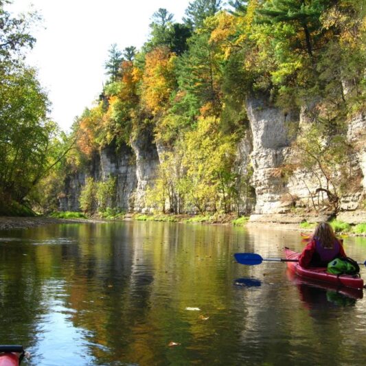
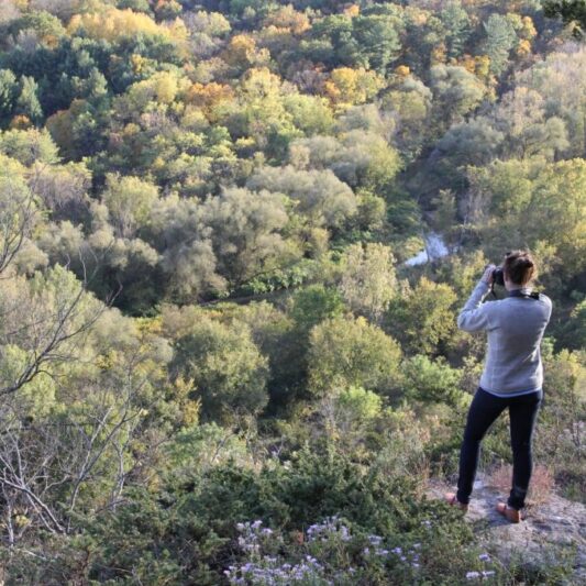
The River Bluffs Scenic Byway plays hide and seek with three rivers, crossing them at times, providing distant views of the river valleys at others. This byway starts and ends with a mesmerizing three-state view of the Mississippi River. Within its Corridor in Fayette and Clayton counties in Iowa, it boasts hidden springs, coldwater streams, bluffs, caves, and algific talus slopes. It also crosses the Silurian Escarpment, which forms the boundary between the landscape regions of the flatter Iowan Erosion Surface and the hilly Paleozoic Plateau/Driftless Area. The Silurian Escarpment is also called the Niagaran Escarpment, as it is associated with the same resistant rock layer that creates Niagara Falls! Picturesque examples of the Silurian Escarpment along the River Bluffs Scenic Byway can be found at Dutton’s Cave County Park, Echo Valley State Park, Goeken Park and other places. The beauty of this region draws visitors to city, county and state parks, nature centers, fishing hotspots, valley and hilltop campgrounds, trails, and overlooks. There are 13 small towns along this rural byway route and more within the byway corridor. The extensive views from some of the highest bluffs and hilltops in Iowa combined with the quaint towns hidden in narrow valleys, inspired the nickname of Iowa’s “Little Switzerland.” Three of the small towns are tucked between the limestone bluffs and the Mississippi River, McGregor, Marquette and Guttenberg. They have a distinct character that only small river towns have as well as stories of how caves and blufftops were used by Native Americans and European settlers. Several stops along this 109-mile byway provide opportunities to enjoy karst features. There are private caves along the route, including Spook Cave, as well as public waterfalls like Bridal Veil Falls in Pikes Peak State Park. Several overlooks and pull outs, including the overlook at Chicken Ridge, provide a bird’s eye view of the karst landscape and watersheds. In this area, there are dozens of historic sites and hundreds of stone features made of the limestone bedrock that is so close to the surface in the Driftless Area.
Managed by: Northeast Iowa Resource Conservation & Development
More Info:
https://www.traveliowa.com/trails/river-bluffs-scenic-byway/11/
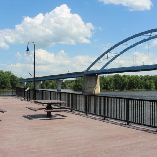
Marquette Scenic Overlook & Mississippi River Boardwalk
The Boardwalk is at the end of the main street through Marquette. The Overlook can be accessed by car at the end of a short street called Emma Big Bear Trail or through the Cobblestone Inn & Suites hotel.
Coordinates: 43.04555437465682° N, -91.17772007729664° W
Officially named the Marquette-Joliet Bridge Scenic Overlook, this scenic overlook is tucked into a limestone bluff above the community of Marquette. It provides an expansive view of the Upper Mississippi River Valley. Just below the overlook, at the bottom of the bluff, the Mississippi River Boardwalk in Marquette provides a different perspective of that same valley. Combined, these two attractions create a unique stop for visitors who want to better understand the Driftless Area, the Mississippi River and the bluffs.
Any fees?: No; it’s free!
Dog Friendly?: Yes (must be leashed)
More Info:
https://www.marquetteiowa.city
https://www.traveliowa.com/trails/river-bluffs-scenic-byway/11/
Backbone State Park
1347 129th St. Dundee, IA 52038
There are multiple entrances to this park but be aware that they all lead to different places. You can not reach every feature in the park from any one entrance.
Coordinates: 42.61742291963833° N, -91.55652753136711° W
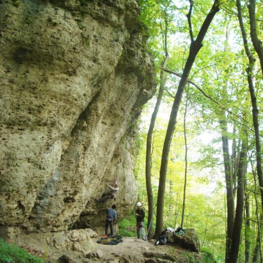
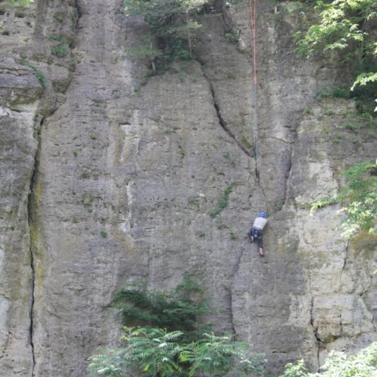
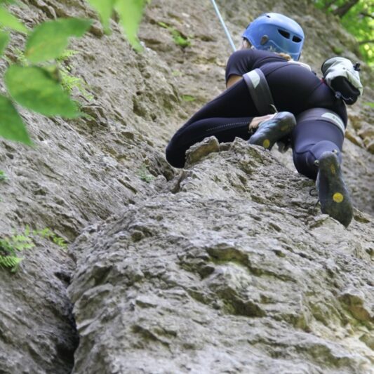
Dedicated in 1920 as Iowa’s first state park, Backbone State Park is one of the most geologically unique locations in Iowa, a great place to see karst features, and wonderful place to experience many of the activities that abound in the Driftless Area of Iowa, including rock climbing, trout fishing, hiking, fishing, swimming and cave exploration. One of the favorite hikes for visitors is along the Backbone Trail, also known as the Devil’s Backbone. This narrow rocky trail is not only fun to climb around on and maneuver, it is the best place in Iowa to see and walk on the Silurian Escarpment. The Silurian Escarpment is a geological formation that marks the boundary between the landscape regions of the flatter Iowan Erosion Surface and the hilly Paleozoic Plateau of the Driftless Area. The Silurian Escarpment is also called the Niagaran Escarpment, as it is associated with the same resistant rock layer that creates Niagara Falls! There are several other biking and hiking trails through the hilly forests of this park, numerous overlooks, a cave to explore and a small lake where families enjoy fishing, paddling, and playing. Rock climbing clubs and classes frequently meet in this park to climb the limestone bluffs. There are cabins, campgrounds, picnic and event shelters, and great lake and stream fishing for anglers. There are numerous, historic limestone structures throughout the park that were built by the CCC with the local limestone that lies so close to the surface.
Any fees?: No (visitation); Yes (overnight camping)
Dog Friendly?: Yes (must be leashed)
Managed by: The Iowa Department of Natural Resources – Parks
More Info:
https://www.iowadnr.gov/Places-to-Go/State-Parks/Iowa-State-Parks/Backbone-State-Park
Manchester Fish Hatchery and Spring Branch Creek
22693 – 205th Ave., Manchester, IA 52057
Coordinates: 42.462063078166686° N, -91.39757596908798° W
The Manchester Fish Hatchery, located 4 miles southeast of Manchester, has a long and storied history. The first fish were produced here in the 1890’s. It was operated by the U. S. Fish and Wildlife Service until 1976 when it was given to the State of Iowa via a land trade. Since 1976, it has functioned as Iowa’s trout broodstock station where trout are spawned, incubated and hatched each year to produce over 600,000 fish for stocking in Iowa waters. Fish spawned at this location are not only stocked into local coldwater trout streams, they are also transported to Decorah and Big Spring hatcheries to be stocked into dozens of coldwater trout streams throughout Iowa’s Driftless Area. Personnel at this hatchery spawn, incubate and hatch rainbow, brook and brown trout. They also give guided tours, public presentations, and host science classes. You can park at the hatchery and walk through the “raceways” where the fish are held and get a close-up view, or bring fishing gear and fish in Spring Branch Creek. Spring Branch Creek, which is fed by a coldwater spring, flows through the property. Trout are visible in the clear cold water. A short trail, complete with a walking bridge, provides another diversion.
Any fees?: No; it’s free!
Dog Friendly?: Yes
Managed by: The Iowa Department of Natural Resources
More Info:
https://www.iowadnr.gov/About-DNR/DNR-Staff-Offices/Fish-Hatcheries
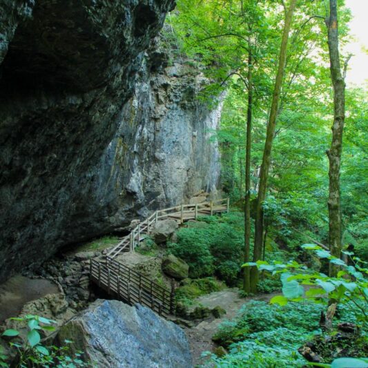
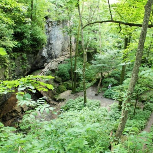
Dutton’s Cave Park
25243 Ironwood Rd. West Union, IA 52175
Coordinates: 42.99714268222877° N, -91.76587251670693° W
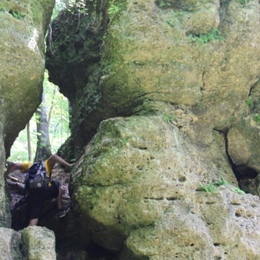
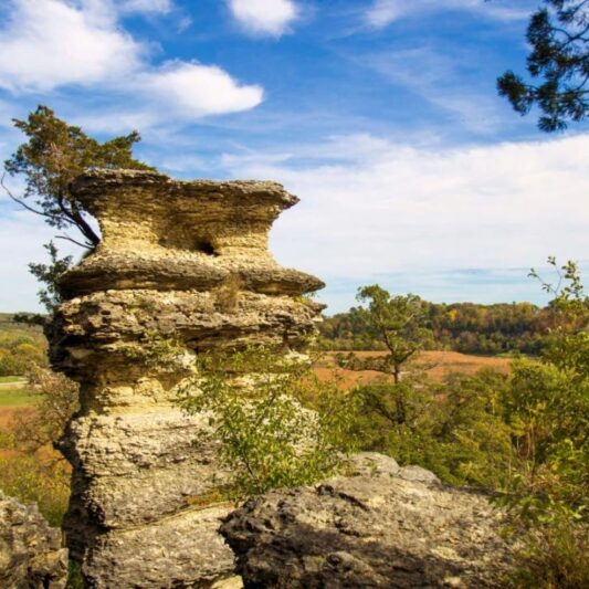
This beautiful 46-acre park features a mature forest with several karst features such as coldwater streams and a narrow cave opening. It is located on a geological landform known as the Silurian escarpment. This assemblage of rocks is nearly 400 Million years old. The Silurian escarpment divides the Iowa Surface and the Paleozoic plateau. Duttons Cave was once a more extensive larger cave system that developed during the interglacial period after the last glaciation of the driftless area some 500,000 years ago. As the nearby Turkey River cut through the bedrock, deeper valleys of the caves were developed, some of which collapsed to form valleys like Dutton’s Cave. This park has trails, picnic areas, and a small campground with two electrical sites and several primitive sites. The cave is CLOSED to help protect bats from the spread of white-nose syndrome. Hunting is not allowed at this park.
Any fees?: No; it’s free!
Dog Friendly?: Yes
Managed by: The Fayette County Conservation Board
More Info:
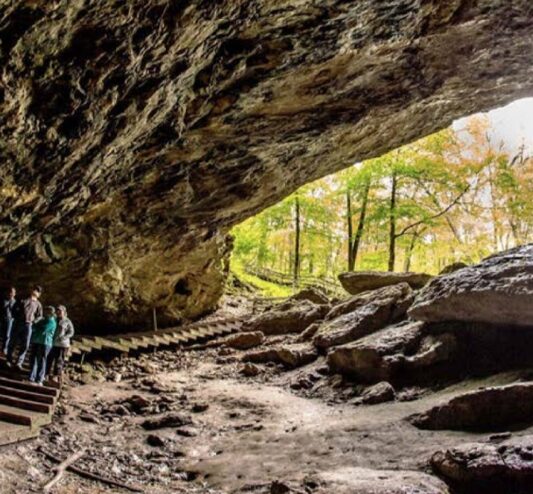
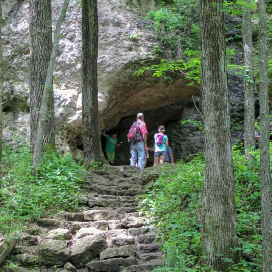
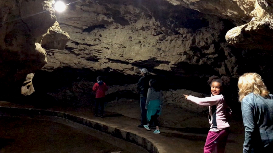
Maquoketa Caves State Park
9688 Caves Rd., Maquoketa, IA 52060
Coordinates: 42.1205295029802° N, -90.76573752859653° W
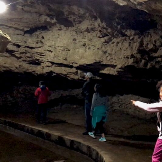
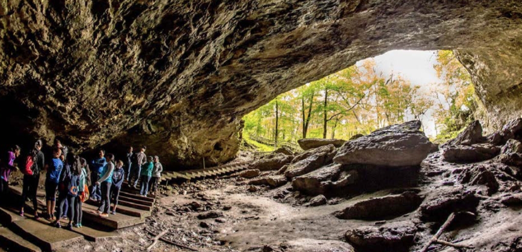
Maquoketa Caves is probably Iowa’s most unique state park. Its caves, limestone formations and rugged bluffs provide visitors a chance to “step back” into geological time thousands of years. Caves vary from the 1,100 feet high ceiling of Dancehall Cave with walkways and a lighting system to the small and dark Dugout Cave. The remaining caves are all different sizes and shapes. Some can be explored by walking while others can best be seen by crawling with a flashlight. The park contains more caves than any other state park in Iowa. Interpreters provide guided tours to facilitate the White Nose Syndrome (WNS) Awareness Program and help prevent the spread of White Nose Syndrome by humans. Attendance at the program is required for those who plan to enter the caves. A beautiful trail system links the caves, formations, and overlooks while providing an exciting hiking experience. Hikers can enjoy the scenery along the six miles of trails. The trails in the eastern part of the park connect the park facilities and provide access to the caves. Trail highlights include the dramatic “Natural Bridge” which stands nearly 50 feet above Raccoon Creek, 17-ton“Balanced Rock”, and “Dancehall Cave.” Beautiful milk white stalactites once hung from the ceilings and stalagmites rose from the floor. Although souvenir hunters have robbed the caves of this rare beauty, some formations still exist. A trail in the western area of the park takes hikers past a restored prairie, an experimental oak savanna restoration and a wildlife food plot. The park changes with the seasons as does the recreational opportunities for the byway traveler. Spring wildflowers give way to the lush green growth of summer. Fall brings dramatic hues of yellow, gold and crimson. Snow transforms the park into a winter wonderland. Early recorded history tells of the Native Americans in the area, and that they were likely visitors to the Raccoon Creek valleys. Artifacts such as pottery, tools and projectile points made of stone found in the caves and surrounding area confirm these accounts. European settlers recognized the unique beauty of the caves in the 1830’s but the first park land was not purchased in 1921. The majority of the park facilities were constructed in the 1930’s by the Civilian Conservation Corps (CCC) and the Works Progress Administration (WPA) including the stone lodge, Dancehall Cave walkway system, stone picnic circle and several hexagonal picnic shelters along the trail. A new interpretive center contains detailed information about the geology of cave formations, park history, and a background of the early “inhabitants” of the park. It also contains a “video tour” of the park, for those who are unable to withstand the rugged terrain that the park offers. The campground contains 29 campsites (17 have full electric hookup) nestled among mature pine trees, complete with a modern shower facility. The beauty of Maquoketa Caves State Park provides a lovely setting for picnicking in the open or under one of the two picnic shelters. A children’s play structure is located between the campground and picnic area.
Any fees?: No (visitation); Yes (camping)
Dog Friendly?: Yes (must be leashed)
Managed by: The Iowa Department of Natural Resources
More Info:
https://www.iowadnr.gov/Places-to-Go/State-Parks/Iowa-State-Parks/Maquoketa-Caves-State-Park

Grant Wood Scenic Byway – Iowa
Coordinates: 42.09088458172731° N, -91.35586626115487° W
Travelers along the Grant Wood Scenic Byway experience people, places, and panoramas very similar to those that inspired American painter Grant Wood to create his most iconic art work. When he was asked to describe how the area he grew up in shaped his work, Grant Wood said “… I’d been told that the Midwest was flat and ugly and I believed it. Later, after I realized the material around me was paintable and started painting out of my own experience, my work had an emotional quality that was totally lacking before.” Visitors traveling along the GWSB have an opportunity to experience some of the same emotions that inspired Grant Wood. A historic quarry and the community of Stone City, Iowa are located at the most western point of the GWSB. Stone City was made famous in Grant Wood’s paintings of the town by the same name, by the Art Colony Grant Wood started there, and by the limestone quarries that have shaped the city’s appearance and economy. The mid-point of the byway is the city of Maquoketa, where the byway branches to create a loop to the north that provides access to several state, county, and municipal parks, most notably the arching limestone caves of Maquoketa Caves State Park. After seventy-five miles, the byway reaches its eastern most point at the Mississippi River in the city of Bellevue. Bellevue is an all- encompassing east end to the byway, as it offers parks with grandiose views of the Mississippi River and its valley.
Managed by: Shared between groups
More Info:
https://www.traveliowa.com/trails/grant-wood-scenic-byway/5/
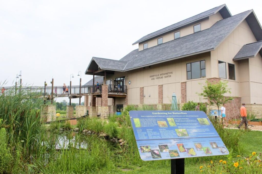
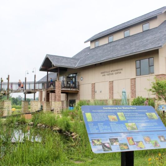
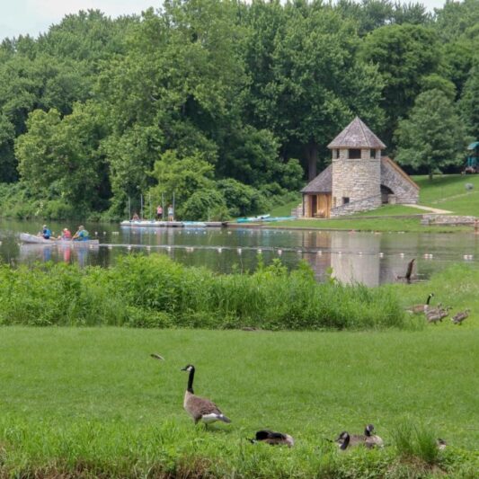
Hurstville Interpretive Center
18670 63rd Street, Maquoketa, Iowa 52060
The center is located 1 mile north of Maquoketa on U.S. Highway 61 and 63rd Street.
Coordinates: 42.088544098170715° N, -90.68179241796955° W
The Hurstville Interpretive Center has interior and exterior interpretive displays, a visitors center and houses the headquarters of the Jackson County Conservation Board. It is easy to access and has universally accessible opportunities for byway travelers to explore and learn about natural resources at their leisure. The visitors center offers information about the surrounding area and points of interest. Inside exhibits tell the story behind the region’s natural and historic resources through live animals, scale models, displays, interpretive panels and events. The Center also houses traveling exhibits regularly that give visitors a unique experience every time they visit. One of the most popular exhibits at the Center is a live bee hive with a 360 degree viewing opportunity. Byway travelers can enjoy the beauty of prairie and wetland ecosystems on the walking trails, spy a pair of nesting trumpeter swans, or use their binoculars to watch for other wildlife. The restored native prairie provides an opportunity for byway travelers to seek and find reptiles, colorful wildflowers, and a world of insects first hand. The butterfly garden encourages visitors to get an up close look at the native flowers that once graced most of Iowa, photograph butterflies and insects, and consider the scope of Iowa’s lost ecosystems.
Any fees?: No; it’s free!
Dog Friendly?: Yes (must be leashed)
Managed by: The Jackson County Conservation Board
More Info:
https://www.mycountyparks.com/county/Jackson/Park/Hurstville-Interpretive-Center.aspx
Crystal Lake Cave – Dubuque County
Coordinates: 42.43414648641558° N, -90.6210701582125° W
Discovered in 1868 by James Rice, a lead miner in search of ore-bearing stone, Rice’s Cave was found to contain a fabulous collection of crystals including argonite, travertine, satin stalagmite, stalactite, and calcareous spar. Originally access to the cave was reached by riding in a bucket lowered by rope down a forty-five foot shaft. After change of ownership, the 1930s, the site was developed as Crystal Lake Cave.
Any fees?: Yes (Adults: $20 each; Ages 4-11: $8 each; Ages under 4: free)
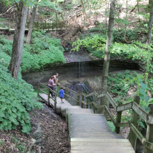
Pikes Peak State Park
32264 Pikes Peak Rd, McGregor, IA 52157
Coordinates: 43.00572529688673° N, -91.17414240973142° W
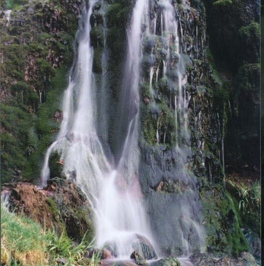
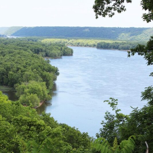
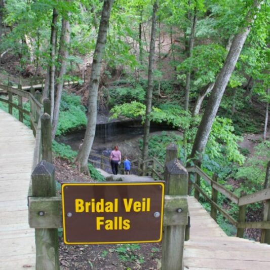
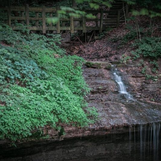
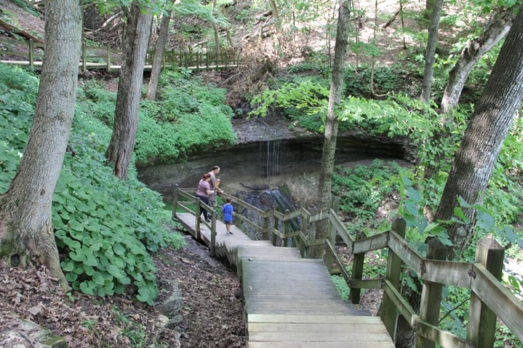
Famed for its majestic views of the Mississippi River, Pikes Peak State Park is one of Iowa’s premier natural, cultural, and historic destinations. Located at the intersection of the Great River Road National Scenic Byway and the River Bluffs Scenic Byway (Iowa byway) it should come as no surprise that the views of the Mississippi River Valley are breathtaking! You can enjoy a spectacular view from park overlooks that are within sight of the parking area or venture further along boardwalks and walking paths. The park features 11 miles of relatively easy trails with various views of the scenic bluffs and valleys that are at the heart of the Driftless Area. One of the most popular trails is a half-mile trail along a boardwalk with numerous overlooks to the Bridal Veil Falls, a unique and quaint little waterfall that is wider than most. Like other karst waterfalls, the amount of water flowing over Bridal Veil Falls is directly related to rainfall and its impact on surface and groundwater flow. If you want a longer hike, consider the path to Point Ann overlooking the nearby town of McGregor or see where the Mississippi and Wisconsin Rivers meet atop a 500-foot bluff, along the way you can detour to see Native American Indian Mounds. The campground in this park is also located on the bluff and surrounded by hardwood forests that explode with color in the fall. Biking is allowed on designated trails and local cross country skiing clubs help maintain ski friendly trails when snow allows.
Any fees?: No (visitation); Yes (overnight camping)
Dog Friendly?: Yes (must be leashed)
Managed by: The Iowa Department of Natural Resources – Parks
More Info:
www.iowadnr.gov/Places-to-Go/State-Parks/Iowa-State-Parks/Pikes-Peak-State-Park
Great River Road National Scenic Byway – Iowa
Coordinates: 43.50452291292317° N, -91.26416015625° W
The Great River Road National Scenic Byway in Iowa follows the Upper Mississippi River through the heart of the Driftless Area. It weaves through the river valley between limestone bluffs and the Upper Mississippi National Fish and Wildlife Refuge. This byway provides access to dozens of county, state and federal parks and wildlife areas that have karst features and recreational opportunities. The overlooks along this route provide an opportunity for you to slow down and see the unique landscape from some of the tallest bluffs in the Driftless Area. Watch for overlooks along the road north and south of Guttenberg, just a short drive up the hill to Mount Hosmer Park in Lansing, hiking trails that lead to spectacular overlooks in Effigy Mounds National Monument, easy access but stunning overlooks in Pikes Peak State Park, multiple overlooks that you can reach by driving up one-lane roads into the center of Yellow River State Forest. Views at river level are also abundant including in Harpers Ferry and at Guttenberg’s River Walk. If you’re looking for waterfalls, don’t miss Big Springs City Park just outside Guttenberg (not to be confused with Big Springs along the Turkey River), and Bridal Veil Falls in Pikes Peak State Park (just a short hike along a boardwalk). Many of the local and state parks along the Great River Road in Iowa boast coldwater trout streams. Yellow River State Forest is a great place to pursue an elusive trout, but is perhaps most well known as a designated World Birding Area, not only for bird diversity but also because it harbors many threatened and endangered species that you may not see in other places. The Driftless Area of Iowa is a especially known for its high quality birding opportunities and the Great River Road National Scenic byway might just be the best way to experience the diversity of species that enjoy the hardwood forests, wetlands, blufftops and riverine habitats of the Driftless Area. To find out more, stop in the Driftless Area Education and Interpretive Center just south of Lansing.
Any fees?: No (visitation); Yes (overnight camping [vary by park])
Managed by: The 10-State Mississippi River Parkway Commission
More Info: