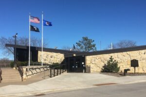
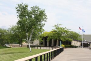
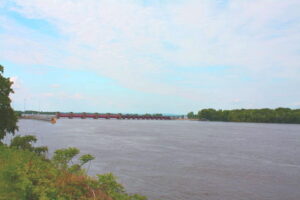

Dresbach Welcome Center
33020 Highway 61, La Crescent, MN, 55947
The entrance is a left off of River Access Road and the Welcome Center will be the first building to the right.
Coordinates: 43.8596061054827° N, -91.30443533148704° W
Overlooking lock and dam #7, Dresbach sits perched on the Mississippi River. The views seen here demonstrates the presence of a karst terrain adding to the geological interest of the area. The deep river valleys such as the Mississippi, sinkholes, caves and limestone bluffs are products of geological processes unique in the Midwest. The resulting topography provides a basis for all other resources and is the reason for the scenic and recreational opportunities of the region. This area is known as the Driftless Area, referring to the absence of glacial drift, or debris, from the Wisconsinian glacier which covered most of Minnesota and Wisconsin but did not extend to this area. Bluff Country rivers and streams represent older and more developed drainage systems than areas with more recent glaciations. This older topography has preserved Pre-Wisconsinian area not otherwise found in the region.
Any fees?: No, it’s free!
Accessible?: Yes
Dog Friendly?: Yes (leashed outside), No (in the Visitor Center)
Difficulty: Easy
More Info:
https://www.exploreminnesota.com/profile/dresbach-welcome-center/2073
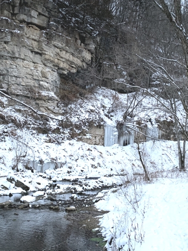
Big Spring – Beaver Creek Valley State Park
15954 County Rd. 1, Caledonia, MN, 55921
The entrance is a parking lot on the right if heading West on County Road 1.
Coordinates: 43.64441777663155° N, -91.5808460145664° W
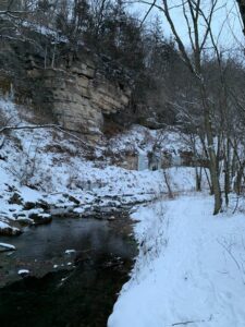
Big Spring, the source of Beaver Creek, became part of Beaver Creek Valley State Park in 1937. As slightly acidic water seeps into and follows fractures in the bedrock, it slowly dissolves the carbonate limestone rock and gradually enlarges the cracks. Continued erosion along these passageways develops a system of underground drainage that bypasses the surface drainage pattern. As a result, groundwater can move quickly to replenish an underground reservoir, and then, as is the case at Big Spring, escape through porous rock layers to finally emerge as a bubbling spring.
Any fees?: No, but a State Park vehicle permit is required.
Accessible?: No
Dog Friendly?: Yes
Time to Complete: 30 minutes
Distance: 1/2 Mile (roundtrip)
Difficulty: Easy
Maintained by: The Minnesota Department of Natural Resources
More Info:
https://www.dnr.state.mn.us/state_parks/park.html?id=spk00112#homepage
Historic Bluff Country Scenic Byway
Route: Hwy. 16 between La Crescent and Dexter, small loop on US-52 and MN-80 also connects Wykoff and Fountain; a scenic alternative to I-90.
Explore the Karst topography of the Driftless Area by vehicle or bicycle. This 88 mile national scenic byway follows the Root River through deeply carved valleys dominated by towering limestone cliffs. Travel the byway to the Lanesboro Fish Hatchery and other locations within the Discovery Areas.
Any fees?: No, it’s free!
Accessible?: Yes (by car)
Dog Friendly?: Yes
Time to Complete: 4-8 hours
Distance: 88 Miles
More Info:
https://www.dnr.state.mn.us/state_parks/park.html?id=spk00160#homepage
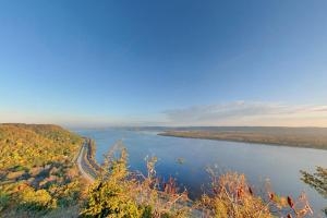
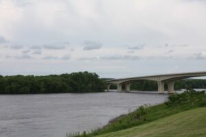
Great River Road
This section of the Great River Road National Scenic Byway follows the Mississippi River for 39 miles and takes you to John A Latsch State Park and to the Dresbach Welcome Center. The Mississippi River has spent the last 12,000 years carving cliffs into the ancient rocks. These cliffs of soft, white sandstone (called the St. Peter Sandstone) are the lithified remains of the expansive beaches of an Ordovician sea that covered the mid-west 450 million years ago. A look at these sand grains through a magnifying glass reveals sand that has been washed clean and made perfectly round from millions of years of tidal action. Small holes in these cliffs are produced naturally by wind and rain and provide homes for birds. Larger ones were created by people mining the sand for glass bottle production.
The Mississippi River – Lake Pepin watershed consists of forests, bluff lands, and cultivated lands. The top of the watershed is rolling cropland interspersed by many small tributaries that drop steeply through forested valleys with scattered goat prairies atop cliffs. The tributaries join to form the named streams, which drain directly into the Mississippi River. The watershed is only about 50 miles southeast of downtown St. Paul. As a result, the watershed is subject to development pressures.
More Info:
https://www.pca.state.mn.us/water/watersheds/mississippi-river-lake-pepin
https://www.nps.gov/miss/learn/nature/twingeol.htm