Coldwater Cave State Preserve
Located 3 miles northwest of Bluffton off of Coldwater Creek Road
Coordinates: 43.43432199496354° N, -91.94785837761273° W
Coldwater Cave State Preserve is a 60-acre public area. It encompasses Coldwater Spring, which bubbles out of Coldwater Cave, one of the most extensive karst cave systems in the Driftless Area. It also encompasses four miles of Coldwater Creek, which is one of several coldwater trout stream tributaries to the Upper Iowa River that is open to public fishing. Coldwater Cave, Iowa’s longest and most spectacular cave, is located beneath the gently rolling hills of farm country north of the State Preserve in Northeast Iowa and Southeast Minnesota. Considered as the most significant cave system of the Upper Midwest karst region, Coldwater Cave was designated a National Natural Landmark by the U.S. Department of the Interior in 1987. This status is accorded to geologic and ecological features considered to be of national significance. Since its discovery in the late sixties, over 20 miles of passages have been documented. The cave system, which is relatively young and still forming, is part of a fluvio-karst drainage basin located in northeast Winneshiek County, Iowa and southeast Fillmore County, Minnesota. The cave proper is situated in the Iowa part of that basin. Formed almost entirely within the Dunleith Formation of the Galena Group (Ordovician), the cave consists of over four miles of borehole and stream gallery, nearly a mile of parallel stream passage and another 11 miles of infeeders and their associated offshoots. The cave system, which is dendritic in its layout, is developed within a subtle carbonate ridge bounded by surface drainages; some of the side passages cross under these drainages. The entire area is mantled with loess and glacial till. There is only one natural entrance to the cave. It is the water-filled spring that issues from the base of a 150 foot-tall bluff located within the Coldwater Cave State Preserve. Visitors can hike along a designated path to see this entrance, but this underwater entrance is currently gated. This cave is NOT open to tourists. Due to extremely difficult access, fluctuating water levels, and risk of injury, only a few experienced adult cavers are granted limited, guided access.
Any fees?: No, it’s free!
Dog Friendly?: Yes
Time to Complete: 2 hours
Managed by: The Iowa Department of Natural Resources
More Info:
https://www.iowadnr.gov/idnr/Fishing/Where-to-Fish/Trout-Streams/Stream-Details?lakeCode=TCO96
Decorah Ice Cave State Preserve
Decorah Ice Cave State Preserve is famous for the unusual deposits of ice which coat its walls and persist most of the year. Ice is thickest in summer and early fall. The cave is located beneath a south-facing wooded bluff of Ordovician-age Galena Group limestones exposed along the valley of the Upper Iowa River. It is believed to be the largest known ice cave in eastern North America. The cave passage follows a prominent vertical fracture through the limestone, enlarged by the slipping of large rock blocks downslope. Ice formation is caused by the sinking of cold air into the cave during winter along a network of crevices which extend back into the uplands north of the bluff. Continued ice build-up occurs with the spring when spring thaw surface water seeps into the cave and is frozen when it comes into contact with the cold rock walls, ice, and entrapped cold air. Ice accumulation begins to accumulate in March, reaches a maximum thickness of 8 to 10 inches by June, and remains until August or September. The cave has an interesting history of scientific investigation and was shown as a commercial enterprise from 1929 until 1941. Decorah Ice Cave is open to the public as an “enter at your own risk” attraction, Visits in the winter time are not recommended. A steep flight of limestone stairs leads from Ice Cave Road to the cave entrance. Minor children must be accompanied by an adult, and a good flashlight is recommended. Visitors are asked to use caution, as the inside of the cave gradually slopes and there is usually ice present on the walls and floor. Currently the Ice Cave is blocked-off 10 feet into the cavern due to safety concerns. Though the cave extends farther back, in the late 90’s the Iowa DNR Geological Survey Bureau required a permanent barrier be installed to keep visitors from exploring further into the cave where the DNR determined some rock movement. There are other interesting above-ground geologic formations on the three-acre site. Visitors are also cautioned not to disturb any loose rocks inside the cavern. Considered by some to be the most geologically interesting cave destination in Iowa, it has been a state geological state preserve since 1973 and was placed on the national Register of Historic Places in 1978. This cave also has a fun social history. Stories circulate that past Decorah residents used ice from the cave to make ice cream or cool off contraband six-packs of beer.
Location: Ice Cave Road, Decorah, Iowa 52101
Directions: Ice Cave Road is a closed road. Dunning’s Spring Park and Ice Cave are accessible from the west end of Ice Cave Road. Visitors should park in the gravel lot on the south side of the road.
Any fees?: Day-use, No Fees
Dog Friendly?: Yes
Managing Agency: Iowa DNR Fisheries
Time Needed: 1 Hour
Upper Iowa River Access – Iowa
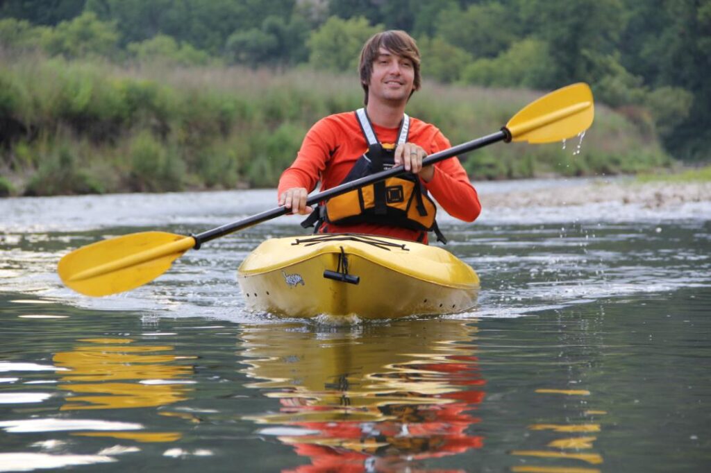
The Upper Iowa River, a 150-mile tributary of the Upper Mississippi River, is primarily located in the Driftless Area of Northeast Iowa. One of the most beloved rivers in the Midwest, it is the only Iowa river to be nominated for inclusion in the nation’s Wild and Scenic Rivers Program. Canoeing the Upper Iowa River has been recommended as one of the top 100 adventures in the United States by National Geographic Adventure Magazine.
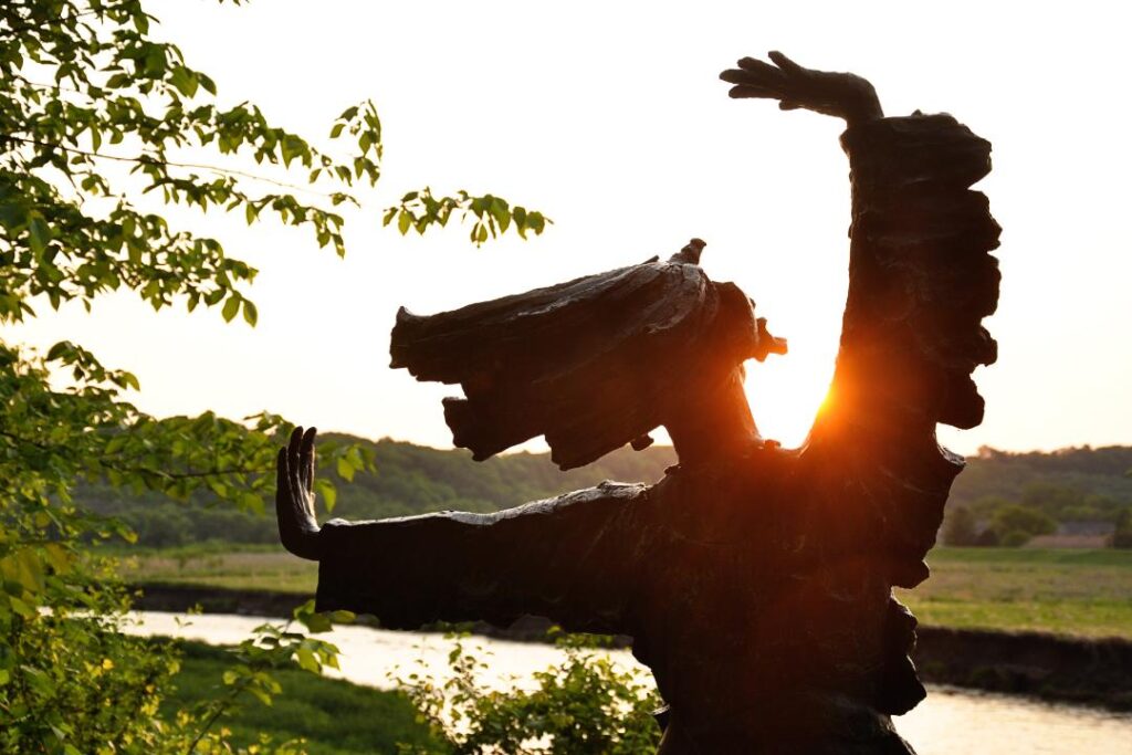
The remote nature of the river, towering limestone bluffs, public natural areas, exceptional fishery, and abundant wildlife, draw visitors from around the world. The Upper Iowa River Watershed boasts waterfalls, dozens of coldwater trout streams, native prairie, hardwood forests, bucolic farms and small villages and towns. After decades of private and public watershed conservation efforts, the Upper Iowa River and its streams are restored to function as a coldwater system, with trout moving back and forth between the river and its tributaries. In addition to paddling to see the spectacular bluffs, visitors enjoy bird and wildlife watching, fishing for trout, walley, and bass, or just feeling isolated from the world as they drift through the remote Upper Iowa River Valley. A must see karst feature on the river is the Bluffton Bluffs, a 300 foot bluff that towers over the river just upstream of Bluffton, Iowa. This river remains both scenic and wild so be prepared. Both the landscape surrounding the river and the character of the river change dramatically as the river winds its way to the Upper Mississippi River and the Upper Mississippi Fish and Wildlife Refuge so be sure to pick up a map and check out the 360 video to plan your trip.
Fees: Day-use, No Fees
Dog Friendly?: Yes
Managed by: Public-Private Partnership
Phone: 563-864-7112
Email: Admin@NortheastIowarcd.org
Website: https://upperiowariver.org
Time Needed: 1 to 5 days
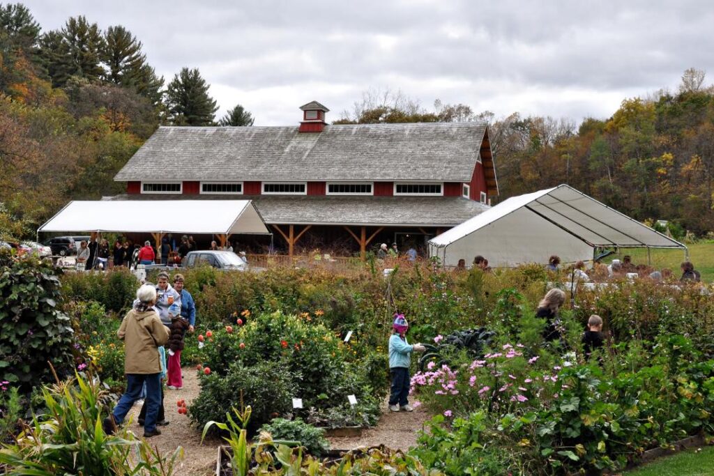
Seed Savers Exchange
Along the Driftless Area Scenic Byway, Seed Savers Exchange has been in operation since 1975. They grow, save and share heirloom seeds and are known worldwide for their leadership to protect biodiversity and for their protection of over 20,000 different heirloom varieties of vegetables, fruits, and livestock. Visitors enjoy display gardens featuring vegetable and fruit varieties from their collection, a historic orchard with over 900 varieties of apple trees, heritage poultry breeds, ancient white park cattle, a restored barn and the Lillian Goldman Visitors Center. Less well-known, the Seed Savers property also boasts a restored native trout stream and miles of hiking trails where visitors can fish, hike, or just enjoy the hills and valleys of Iowa’s Driftless Area.
Fees: Day-use, No Fees
Dog Friendly?: Yes
Managed by: Seed Savers Exchange
Phone: 563-382-5990
Website: https://www.seedsavers.org
https://blog.seedsavers.org
Malanaphy Springs State Preserve
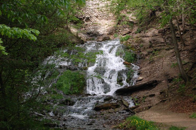
Malanaphy Springs State Preserve is a 64-acre public area along the Upper Iowa River near Decorah Iowa. This forested Preserve’s most well known feature is its waterfall. Cold spring water issues from a small cave to tumble over porous limestone rocks. It forms a series of cascading falls and small pools for a 60 foot drop, until it reaches the river. The last 10 feet is the most impressive part of this waterfall and what paddlers on the Upper Iowa River see. From the parking area, visitors can hike a narrow walking path two miles round trip from the parking area to the spring, sometimes dodging trees and rocks. Wildflowers are abundant along this path in spring when the waterfall is most impressive due to spring run off. The steep slopes contain a forest with many rock outcrops throughout. The preserve houses more than 300 native forest plants Although there are dozens of springs which flow into the waters along the Upper Iowa River float from Bluffton to Decorah, Malanaphy Springs is the most well-known spring along the Upper Iowa River.
Location: West of Decorah, Iowa
Directions: From the intersection of IA-9 and US-52 in Decorah, head north on US-52. After a about a mile, turn left onto Pole Line Road and drive just over 2 miles to Bluffton Road. Turn right onto Bluffton Road, and drive about 0.7 miles to a parking area on your right just before you cross the Upper Iowa River. Parking is limited. The most dramatic view of the waterfall is visible to paddlers enjoying the Upper Iowa River.
Fees: Day-use, No Fees
Dog Friendly?: Yes
Managed by: Iowa DNR
Phone: 563-382-2023
Website: https://www.visitdecorah.com/business/malanaphy-springs
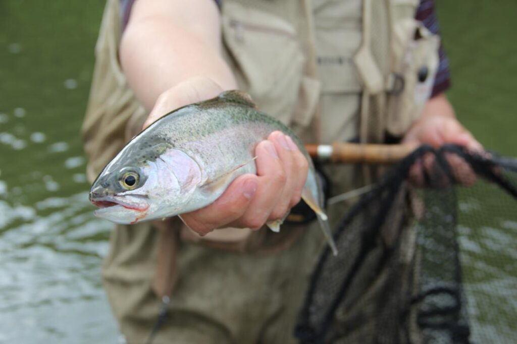
Winneshiek County Trout Fishing
The coldwater springs and streams in the Driftless Area make trout fishing a popular pastime throughout the region. Each state manages their streams differently so check for information about limits, catch and release, and seasons within each state. There are 19 spring-fed creeks in Winneshiek County (Iowa) that comprise over 32 miles of fishable water, four of Iowa’s 10 most-visited trout streams and one of only three trout rearing stations in Iowa. Located in the heart of Iowa’s trout region, Winneshiek County’s tranquil landscape attracts more trout anglers than any other county in the state. Anglers are attracted to this area for its high concentration of prime trout waters, fish counts, increasingly high numbers of natural reproduction, and the active trout stocking plans. Iowa is also the only state in the Driftless Area that allows trout fishing year-round. Different streams support different opportunities to catch naturally reproducing or stocked brook, brown and rainbow trout. Iowa DNR efforts have also contributed to making this region of the state a world-class trout fishery.
On average, the Iowa DNR stocks approximately 76,000 catchable trout into catchable stocked streams within Winneshiek County from April 1 – October 31. In addition to stocking catchable rainbow trout, the Iowa DNR also stocks fingerling brook trout to help restore wild trout fisheries. Streams with wild brook trout populations South Pine, Pine Springs, Pine, Falcon Springs, Casey Springs. In addition, excess brood trout, or adult trout that typically measure between 14 and 24 inches in length and weigh anywhere from two to eight pounds, are released into streams each year.
Fees: Day-use, No Fees, Fish License and Trout Stamp required for fishing
Dog Friendly?: Yes
Managed by: Iowa DNR Fisheries
Phone: 563-382-8324
Email: brian.malaise@dnr.iowa.gov
Website: www.iowadnr.gov/Fishing/Where-to-Fish/Trout-Streams
*For a pocket-sized guide to each of the 13 publicly accessible trout streams, please visit www.northeastiowarcd.org/product/trout-streams-of-winneshiek-county/.
Driftless Area Scenic Byway – Iowa
The Driftless Area Scenic Byway weaves through Winneshiek and Allamakee Counties. The sites in this Discovery Area are located within the “corridor” of the byway, which includes all of Allamakee County and a large portion of Winneshiek County. Northeast Iowa Karst topography dominates the Driftless Area Scenic Byway (DASB) Corridor. The rugged terrain is well developed with caves, sinkholes, springs, cold water trout streams, exposed bedrock, and steep, highly erodible slopes. The natural resources include the most popular cold water trout streams in the Midwest, one of the highest concentrations of threatened and endangered species in Iowa, a Globally Important Birding Area, and one of the greatest bird flyways in the world. They also include the only national monument in Iowa and one of only four major state forests. The DASB route meanders adjacent to rivers that are nationally recognized for their natural resources, including the Upper Mississippi River (Pool 9), the Yellow River, which is Iowa’s longest and largest cold water trout stream, and the Upper Iowa River, which was the only river in Iowa and one of the first in the nation to be nominated for inclusion into the National Wild and Scenic River Program.
Managed by: Northeast Iowa Resource Conservation & Development
More Info:
Ice Cave State Park
Decorah Ice Cave State Preserve is famous for the unusual deposits of ice which coat its walls and persist most of the year. Ice is thickest in summer and early fall. The cave is located beneath a south-facing wooded bluff of Ordovician-age Galena Group limestones exposed along the valley of the Upper Iowa River. It is believed to be the largest known ice cave in eastern North America. The cave passage follows a prominent vertical fracture through the limestone, enlarged by the slipping of large rock blocks downslope. Ice formation is caused by the sinking of cold air into the cave during winter along a network of crevices which extend back into the uplands north of the bluff. Continued ice build-up occurs with the spring when spring thaw surface water seeps into the cave and is frozen when it comes into contact with the cold rock walls, ice, and entrapped cold air. Ice accumulation begins to accumulate in March, reaches a maximum thickness of 8 to 10 inches by June, and remains until August or September. The cave has an interesting history of scientific investigation and was shown as a commercial enterprise from 1929 until 1941. Decorah Ice Cave is open to the public as an “enter at your own risk” attraction, Visits in the winter time are not recommended. A steep flight of limestone stairs leads from Ice Cave Road to the cave entrance. Minor children must be accompanied by an adult, and a good flashlight is recommended. Visitors are asked to use caution, as the inside of the cave gradually slopes and there is usually ice present on the walls and floor. Currently the Ice Cave is blocked-off 10 feet into the cavern due to safety concerns. Though the cave extends farther back, in the late 90’s the Iowa DNR Geological Survey Bureau required a permanent barrier be installed to keep visitors from exploring further into the cave where the DNR determined some rock movement. There are other interesting above-ground geologic formations on the three-acre site. Visitors are also cautioned not to disturb any loose rocks inside the cavern. Considered by some to be the most geologically interesting cave destination in Iowa, it has been a state geological state preserve since 1973 and was placed on the national Register of Historic Places in 1978. This cave also has a fun social history. Stories circulate that past Decorah residents used ice from the cave to make ice cream or cool off contraband six-packs of beer.
Locations: Ice Cave Road, Decorah, Iowa 52101
Directions: Ice Cave Road is a closed road. Dunning’s Spring Park and Ice Cave are accessible from the west end of Ice Cave Road. Visitors should park in the gravel lot on the south side of the road.
Fees: Day-use, No Fees
Dog Friendly: Yes
Managed by: Iowa DNR
Phone: (563) 382-4158
Time Needed: 1 Hour
Decorah Parks
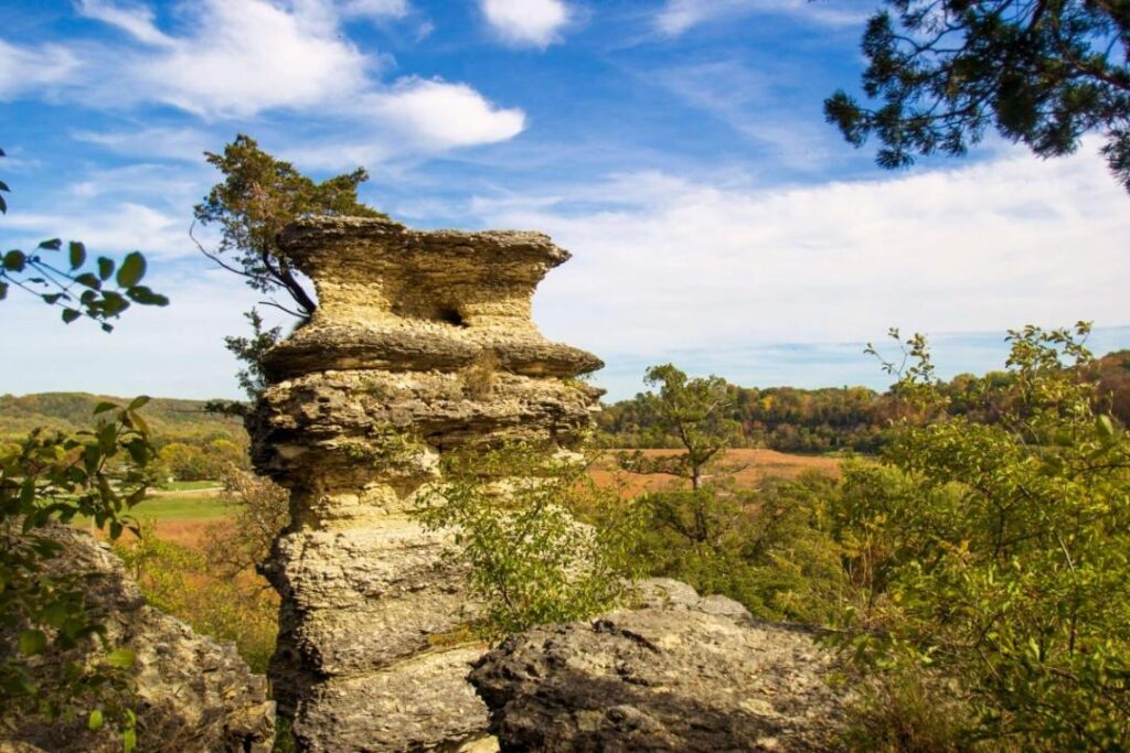
Decorah is one of the largest communities along the Driftless Area Scenic Byway. Located in the Upper Iowa River Valley, the community is surrounded by forested hills and limestone bluffs that hold many karst treasures that have been protected as city parkland. Decorah Parks encompass over 660+ acres of land, including 23 parks and recreational areas, a municipal pool, the city campground, 20 miles of off-road trails, the eleven-mile paved Trout Run Trail, numerous playgrounds, shelters and picnic areas. There are also Iowa State preserves, Wildlife Management Areas, a State Fish Hatchery and Winneshiek County Conservation Board wildlife areas and trails in and near Decorah, which expand the options for exploration. Collectively Decorah’s parks, wildlife areas, and trails, which surround the community like a jeweled necklace, provide an opportunity to experience some of the best examples of karst features in the Driftless Area, including deeply incised rivers, an algific talus slope, towering limestone bluffs and pillars, cascading waterfalls, caves, springs seeping or flowing from the Decorah Shale (which was named for this area), and numerous overlooks and trails that provide expansive views of the Upper Iowa River. There are also multiple river access points for the Upper Iowa River and several coldwater trout streams that flow in or through the parks. Some of the Decorah Park lands have been managed to highlight native ecosystems, including hardwood forests, oak savanna, and tallgrass prairie. Don’t miss highlights include Dunning’s Spring, Twin Springs, Ice Cave State Preserve, Pulpit Rock, and overlooks in Palisades Park and Phelps Park.
Fees: No Fees except for Camping
Dog Friendly?: Yes, Allowed under supervision of guests. Must be leashed at all times. Must not be left unattended.
Managed by: Decorah Park and Recreation
Phone: (563) 382-4158
Email: parkrec@decorahia.org
Website: www.parks.decorahia.org
Time Needed: 2 – 7 Days
Dunning’s Spring Park
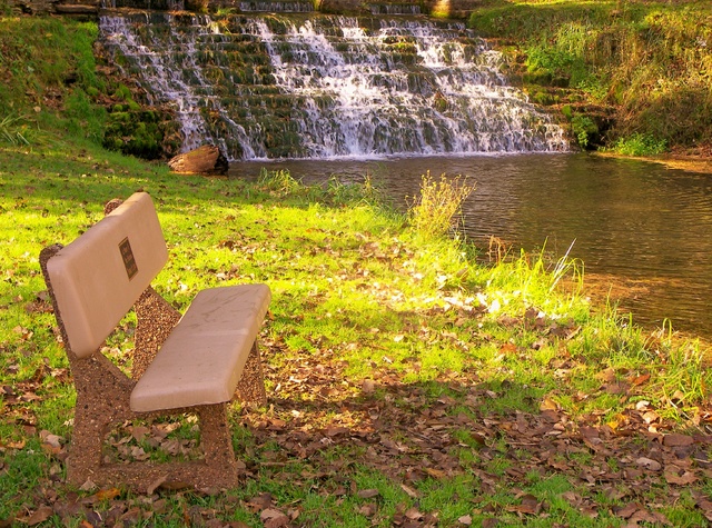
Dunning’s Spring Park might be one of the prettiest attractions in all of Iowa and is home to the most visited waterfall in the state. This small park has a rich history in both commerce and now as a place of recreation. Before it was donated to the City of Decorah, it was once the site of a grist mill and a marble quarry. Today, although no sign of commerce remains, visitors walk to the park to see the continuously flowing 200 foot waterfall, which images from a small cave, cascades down the limestone hill, and feeds a small coldwater trout stream that tumbles into the Upper Iowa River. A bridge, boardwalk and staircase provide access to the top of the bluff to see the spring. This park is actually part of a larger system of Decorah parks that connect to each other and is officially named “Dunning’s Spring Park and Ice Cave Hill”, which have trails and other recreation opportunities.
Directions: Ice Cave Road is a closed road. Dunning’s Spring Park and Ice Cave Hill are accessible from the west end of Ice Cave Road. Visitors should park in the gravel lot on the south side of the road.
Location: Ice Cave Road, Decorah, Iowa 52101
Fees: Day-use, No Fees
Dog Friendly?: Yes
Managed by: Decorah Park and Recreation
Phone: (563) 382-4158
Email: parkrec@decorahia.org
Website: www.parks.decorahia.org
Time Needed: 0.5 to 1 Hour
Chuck Gipp Decorah Fish Hatchery & Siewers Springs
The Chuck Gipp Decorah Fish hatchery is a rearing station for rainbow trout. It is located in the Trout Run Valley at the site of the second largest spring (by volume) in Iowa, Siewers Spring. Limestone bluffs and forested hills create a beautiful setting for the Spring, which provides the cold water the hatchery needs to rear about 130,000 catchable-size rainbow trout each year. The trout raised at this hatchery are stocked into 15 coldwater streams of the Driftless Area in Allamakee, Howard, Mitchell and Winneshiek counties by hatchery personnel from April through October. The picturesque limestone office and residence date back to the 1930s as a project of the Civilian Conservation Corps when the Corp constructed hundreds of buildings out of the native limestone found in this part of the Driftless Area. See the spring and then walk around the hatchery’s 24 cement flow-through raceways and three rubber lined earthen ponds, along Trout Run Creek, and through a native prairie. The site is not only beautiful, it is well interpreted and also within sight of the internationally famous Decorah Eagles Nest.
Location: Decorah, Iowa 52101
Directions: From Highway 9, take Trout Run Road for about 1.5 miles. Turn south on Siewers Spring Road to the hatchery.
Fees: Day-use, No fees. For a quarter, you can buy food to feed the fish. The fish hatchery is open to the public 365 days a year from sunrise to sunset. Group tours can be scheduled by calling the hatchery at 563-382-8324. Office hours are 7:30 a.m. – 4:00 p.m.
Dog Friendly?: Yes
Managed by: Iowa DNR Fisheries
Phone: (563) 382-8324
Email: brian.malaise@dnr.iowa.gov
Website: www.iowadnr.gov/About-DNR/DNR-Staff-Offices/Fish-Hatcheries
Time Needed: 1 – 2 Hours
Trout Run Trail
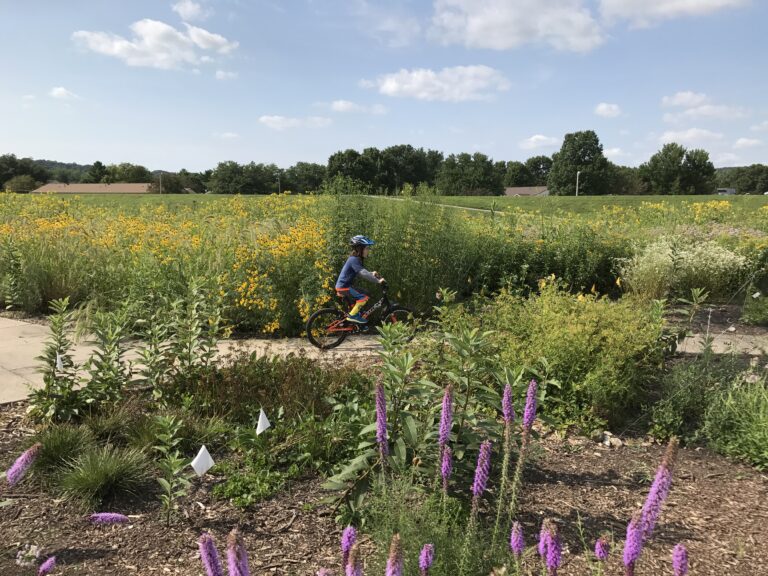
The 11-mile Trout Run Trail provides an opportunity to explore Iowa’s karst landscape through and around the town of Decorah. The trail climbs hills and weaves through valleys past several karst features. The landscape is even more interesting when you know it includes the Decorah Impact Structure, the site where a 660 foot meteorite struck the Upper Iowa River Valley during the Middle Ordovician Period, some 470 million years ago. This trail, and the trails spurs off of it, features three cold water springs, two waterfalls, four cold water streams, several parks with stunning overlooks, and the Upper Iowa River. It passes through rock cuts, skirts an algific talus slope, and provides spectacular views of the Upper Iowa River and the karst landscape. The northern portion of the loop follows the Upper Iowa River between the dike built to protect the town and the river itself. The southern portion of the trail loops out into the hills and valleys south of town. If you start on the west side of Decorah, at 5th Ave. and Pulpit Rock Road, the trail follows along the river, curves right, and then heads left into two campgrounds. At the south end of the campgrounds, you’ll cross a small bridge and then have the option to continue east or cut a sharp right and head south. If you head east, you’ll pass an algific talus slope and find yourself looking down at the Upper Iowa River Valley. Heading south, a switchback climbs and cuts through the rocky limestone bluff up to a small overlook with rock walls on either side of the trail. The bluff that was cut through and subsequent rock feature is a great example of what is underneath the hills in the Driftless Area. The trail route then heads back downhill along the highway (to your right) and then comes to a large intersection, where a newly finished trail overpass bridge glides you to the other side; here, depending on the season, you’ll be greeted by an abundance of wildflowers. The trail heads south and outside of town and then takes a sharp left turn—wiggling you through cornfields and up and down switchbacks. The trail curves through farms along Trout Creek to the Decorah Fish Hatchery. Siewers Spring, the second largest spring in Iowa, bubbles out of the rock into the Trout Run Creek. It also provides the cold water for the trout hatchery. You’ll see limestone bluffs, have an opportunity to feed the fish, and can read interpretive signs as you walk around the hatchery. The famous Decorah eagles nest is visible from the trail near the hatchery. After leaving the hatchery, the trail crosses and follows Trout Run Creek as it flows to the Upper Iowa River where you’ll have the choice to continue along the loop back to Decorah or take the spur to Freeport. Trail maps are available.
Location: In and around Decorah, Iowa
Directions: There are several Trailheads with parking including one at the intersection of Fifth Ave. and Pulpit Rock Road; one at the Walmart Parking lot, which is at the intersection of State Hwy 9 and Co. Rd A52/Old Stage Road, and two other accessible via an access roads at the intersection of US Hwy 52 and State Highway 9.
Fees: Day-use, No Fees
Dog Friendly?: Yes
Managed by: Decorah Park and Recreation and Winneshiek County Conservation Board
Phone: 1-800-463-4692
Website: www.troutruntrail.com
Time Needed: 1-12 Hours