Perched atop the highest point in southern Wisconsin, Blue Mound State Park offers spectacular views and unique geological features. In 1909 Edward Lange completed his University of Wisconsin undergraduate thesis titled, Original Work on the Caves of the Driftless Area of Southwestern Wisconsin. His thesis analyzed several caves, including the “Blue Mounds Cave.” He described the entrance as a sink, “a funnel-shaped depression about 60 feet across the top and reaching about 20 feet below” the surface. The cave measured 250 feet long. Today the cave is inaccessible, however, an exhibit in the nature center explains the park’s geology. Currently, staff enter the caves to survey bat populations every other year or so. Sinkholes (some are gated) can be spotted near several trails, for example, along the south side of the mound during leaf-off conditions. A sign marks one sinkhole on the John Minix Trail near the park’s northern boundary. Niagara dolomite—the same rock that composes the Niagara Escarpment in eastern Wisconsin—caps Blue Mound, as well as Platte Mound, Belmont Mound, and Sinsinawa Mound. These mounds stand hundreds of feet above the surrounding countryside. Rivers and wind have eroded the Niagara dolomite and underlying layers from most of Southwest Wisconsin.
Any fees?: Yes (vehicle admission stickers are required); Guided tours for groups of 8+ for $2/person
This self-guided wooded 1.3-mile trail offers interpretive signs explaining the geology of the Blue Mound area. Watch for flint rock boulders scattered along this trail as the trail takes you along the north side of the mound. Parking can be found near the West Tower.
Accessible?:No
Dog Friendly?:Yes
Difficulty: Easy
Weeping Rock Trail
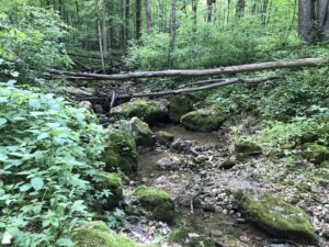
A 1-mile extension of the Pleasure Valley Trail. Descend into a mixed forest of oak and maple trees. The trail follows Ryan Creek, a spring-fed creek, down into the glen. A beautiful rock face wall is at the bottom with water from springs seeping out of it.
Accessible?:No
Dog Friendly?:Yes
Difficulty: Moderate
Ridgeview Trail
Along the south border of the park near the Military Ridge State Trail. It offers spectacular views of the surrounding area with easy access from the campground. The trail has moderate to steep hills.
Accessible?:No
Dog Friendly?:Yes
Difficulty: Moderate/Difficult
Geology Museum of the University of Wisconsin
1215 W. Dayton St., Madison, WI, 53706
Coordinates: 43.07065468058263°N, -89.40597332591936° W
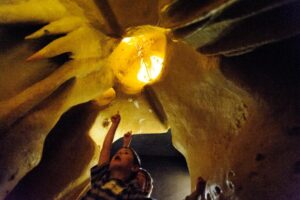
The Geology Museum is free and open to the public and is conveniently located near the heart of campus. A visit to the Geology Museum at the University of Wisconsin in Madison allows you to see and touch some of the oldest rock on Earth as well as explore a model of a Wisconsin cave. Take the geologic knowledge you gained from the museum over to Cave of the Mounds and see first hand a cave developed in the Driftless Area. Small enough to visit in a morning or afternoon, the museum involves a self-guided journey through five different exhibits: rocks and minerals, fossils, dinosaurs, meteorites, and a fluorescent display. If you have a group of eight people or more, guided tours are available for $2 each (call ahead). Smaller kids will be able to enjoy a replica of a cave and touching anything not encased in a formal display.
Any fees?: Yes; Guided tours for groups of 8+ for $2/person
Accessible?:Yes
Dog Friendly?:No
Difficulty: Moderate/Difficult
More Info:
https://geoscience.wisc.edu/museum/
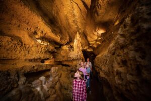
Cave of the Mounds
2975 Cave of the Mounds Road, Blue Mounds, WI 53517-0148
Coordinates: 43.01743910657792° N, -89.81570426954134° W
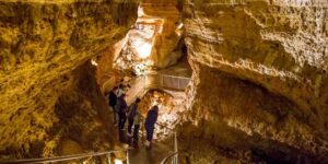
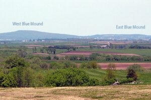
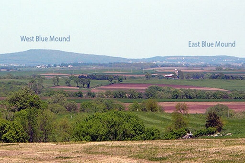
Cave of the Mounds takes its name from the Blue Mounds, two large hills which have long been Wisconsin landmark features. The West Mound, at 1716 feet, is the highest point in Southern Wisconsin; the East Mound reaches 1489 feet. Cave of the Mounds lies under the southern slope of the East Mound. Commonly referred to as the “jewel box” of America’s major caves for the variety and delicacy of its formations, Cave of the Mounds is recognized by the Chicago Academy of Sciences as “the significant cave of the upper Midwest”.
A guided tour of the Cave takes visitors past a varied collection of colorful stalactites, stalagmites, columns and other formations. The main cavern began forming over a million years ago as acidic water dissolved the limestone bedrock far below the surface. As Cave of the Mounds staff like to point out, geologic time is mind-boggling. It is difficult to imagine the time it took for the large caverns to be dissolved within rock that is itself believed to be over 400 million years old! A lower meandering portion of the Cave was formed by the rushing water of an underground stream. The contrast between the chemical and mechanical processes of cave formation is one of the geologic lessons illustrated on The Cave Tour.
Tours are provided on a first come first served basis. Visitors should call or check their website for current conditions.
Any fees?: Yes
Accessible?:Yes (on grounds); No (in cave)
Dog Friendly?:No
Time to Complete:Approx. 1 hour (depending on tour)