Guiding you through the Karst Features of the Driftless Area
Iowa County Discovery Area
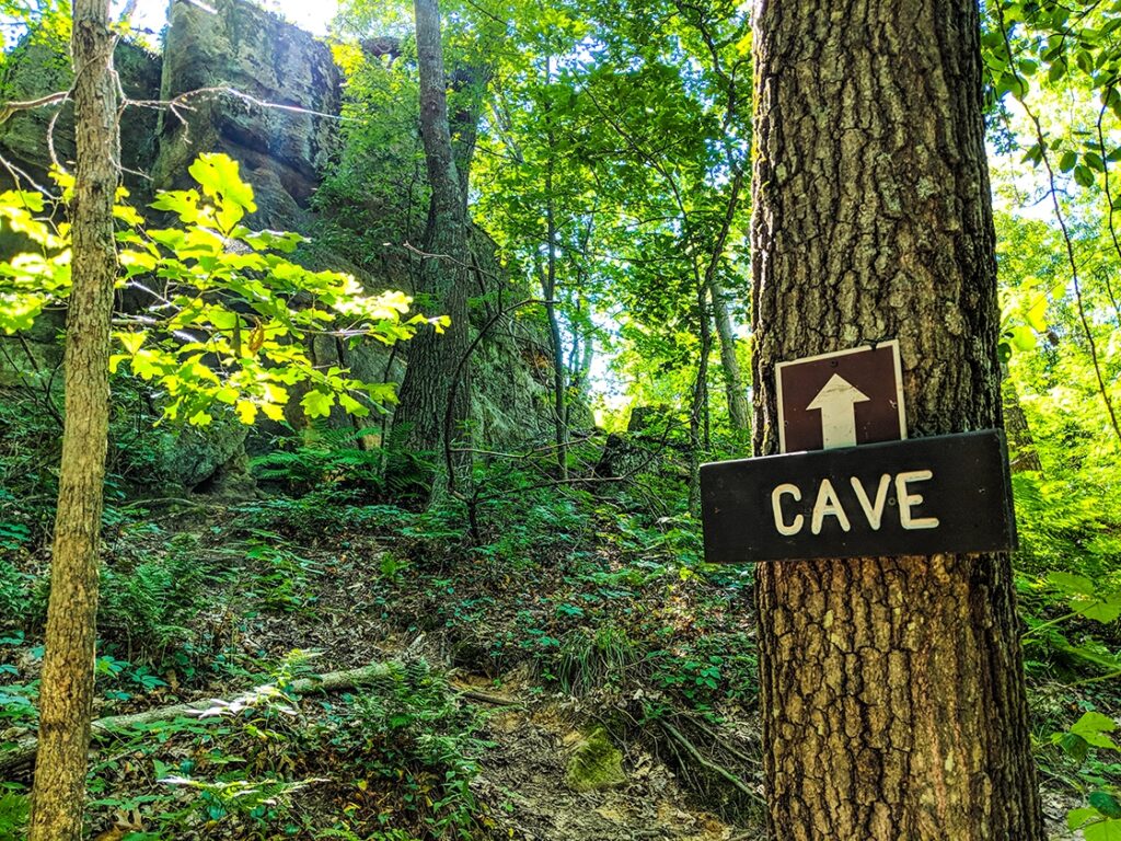
Governor Dodge State Park
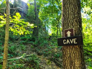
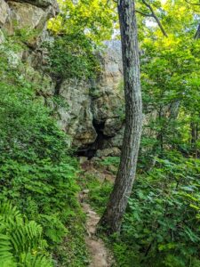
Governor Dodge State Park’s 450-million-year-old sandstone bluffs recall the period when vast, warm seas covered the region, depositing layers of sand, then retreating and returning again and again. Later, wind and water carved the park’s ravines and valleys. Excavations have revealed winter camps established by prehistoric peoples in the sandstone caves and overhangs as much as eight millennia ago. In particular, archaeological investigations at Deer Cove Rock Shelter evidenced early inhabitants. Artifacts, such as projectile points, scrapers, and choppers, discovered in excavated layers were used by both Archaic (8000 to 500 B.C.) and Woodland (500 B.C. to 1600 A.D.) peoples. Two caves, formed in St. Peters sandstone, are accessible from the Meadow Valley Trail. Big Cave, also known as Thomas’ Cave, begins with a three-foot-high entrance and stooping passage leading to a circular, high-ceilinged room. The Small Cave lies beyond and above a rock shelter northeast of Twin Valley Campground. Gates have been installed at the entrances of both caves to protect hibernating bats from human disturbance in the off-season.
Any fees?: No (vehicle admission stickers are required)
Accessible?:No
Dog Friendly?:Yes
Time to Complete:3/4 hour (to Small Cave from the park road), 1 hour (to Big Cave from Twin Valley Campground)
Distance:2-5 Miles
Difficulty: Easy (bring a flashlight and watch for puddles in Big Cave)
This is a 1-mile extension of the Meadow Valley Trail. Take in eye-catching sights of Twin Valley Lake as you walk along a hilly trail that takes you near a large cave known by the locals as Thomas’ Cave. Follow the grey trail markers.
Accessible?:No
Dog Friendly?:Yes
Difficulty: Easy/Moderate
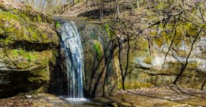
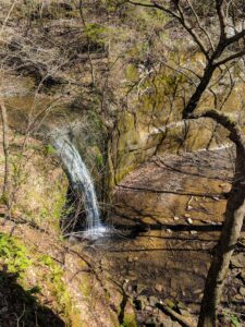
Stephen’s Falls Trail
This is a 0.5-mile picturesque trail that takes hikers past Stephens’ Falls, rock outcroppings and lush ferns as you walk beside a refreshing stream. There is a scenic overlook along a paved trail above the falls. Stone steps and uneven terrain will be encountered to gain access to the falls and the trail below. Follow the dark blue trail markers.
Accessible?:No
Dog Friendly?:Yes
Difficulty: Easy/Moderate
Lost Canyon Trail
This is a 3-mile loop trail that can be reached from the Stephens’ Falls area. The trail has several steep grades. You will encounter mostly wooded areas and will journey into the scenic Lost Canyon which is fed by Stephens’ Falls. Follow the orange trail markers.
Accessible?:No
Dog Friendly?:Yes
Difficulty: Moderate/Difficult
Snow Bottom State Natural Area
Snow Bottom State Natural Area lies in the very heart of a diverse and spectacular Driftless Area landscape. It encompasses the most significant pine relicts in Wisconsin, as well as many other important and uncommon native plant communities including fen and springs, southern dry-mesic forest and oak woodland, riparian areas, and geological features. Located on the scattered sandstone outcrops are the pine relicts — isolated stands of white and red pine with occasional jack pine. To the detriment of the oaks, more mesophytic, shade-tolerant tree species are becoming established under current management practices and fire suppression. Also present is a diverse wetland of calcareous fen and springs that supports numerous calciphitic plants such as shrubby cinquefoil, grass-of-parnassus, Kalm’s lobelia, Ohio goldenrod, boneset, and swamp thistle. The Blue River flows north off the Military Ridge through Snow Bottom to the Wisconsin River. Snow Bottom is owned jointly by the DNR and private landowners and was designated a State Natural Area in 1992.
From the intersection of State Highway 18 and County G west of Montfort, go north on G 4.6 miles, then east on Bowers Road 1.6 miles to a small parking area just west of the Blue River. Walk north into the site. To access the western SNA parcel, from the intersection of County Q and G (located east of Castle Rock), go west on County Q 1.6 miles, then north and west on Cedar Rock Road about 0.4 miles. Walk north into the SNA. A paddle through Snow Bottom on the Blue River is rewarding, but possible only with small kayaks during periods of adequate river flow, usually in spring. The twisty, 5.5 mile section of river from the Bowers Road parking lot downstream to Shemak Road is wild in nature, offering wonderful Driftless Area scenery and excellent trout fishing.