If you would like to select a site directly and explore what else is in this state, please select a location marker above.
If you would like to explore what is in individual counties, please select your county of interest above.
Blue Mounds State Park
4350 Mounds Park Rd., Blue Mounds, WI, 53517
Coordinates: 43.02589101276874°N, -89.84461754682047°W
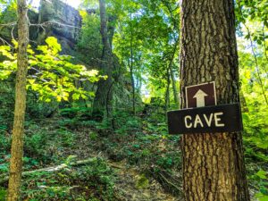
Perched atop the highest point in southern Wisconsin, Blue Mound State Park offers spectacular views and unique geological features. In 1909 Edward Lange completed his University of Wisconsin undergraduate thesis titled, Original Work on the Caves of the Driftless Area of Southwestern Wisconsin. His thesis analyzed several caves, including the “Blue Mounds Cave.” He described the entrance as a sink, “a funnel-shaped depression about 60 feet across the top and reaching about 20 feet below” the surface. The cave measured 250 feet long. Today the cave is inaccessible, however, an exhibit in the nature center explains the park’s geology. Currently, staff enter the caves to survey bat populations every other year or so. Sinkholes (some are gated) can be spotted near several trails, for example, along the south side of the mound during leaf-off conditions. A sign marks one sinkhole on the John Minix Trail near the park’s northern boundary. Niagara dolomite—the same rock that composes the Niagara Escarpment in eastern Wisconsin—caps Blue Mound, as well as Platte Mound, Belmont Mound, and Sinsinawa Mound. These mounds stand hundreds of feet above the surrounding countryside. Rivers and wind have eroded the Niagara dolomite and underlying layers from most of Southwest Wisconsin.
Any fees?: Yes (vehicle admission stickers are required); Guided tours for groups of 8+ for $2/person
Accessible?: Yes
Dog Friendly?: Yes
Difficulty: Easy
More Info:
https://dnr.wi.gov/topic/parks/name/bluemound/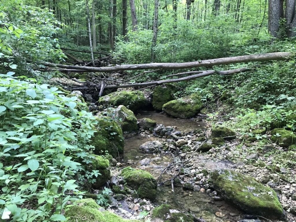
Flint Rock Trail
This self-guided wooded 1.3-mile trail offers interpretive signs explaining the geology of the Blue Mound area. Watch for flint rock boulders scattered along this trail as the trail takes you along the north side of the mound. Parking can be found near the West Tower.
Accessible?: No
Dog Friendly?: Yes
Difficulty: Easy
Weeping Rock Trail
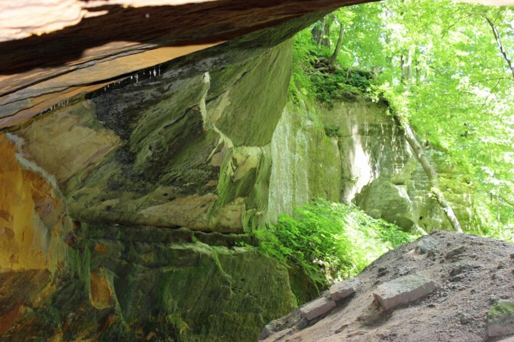
A 1-mile extension of the Pleasure Valley Trail. Descend into a mixed forest of oak and maple trees. The trail follows Ryan Creek, a spring-fed creek, down into the glen. A beautiful rock face wall is at the bottom with water from springs seeping out of it.
Accessible?: No
Dog Friendly?: Yes
Difficulty: Moderate
Ridgeview Trail
Along the south border of the park near the Military Ridge State Trail. It offers spectacular views of the surrounding area with easy access from the campground. The trail has moderate to steep hills.
Accessible?: No
Dog Friendly?: Yes
Difficulty: Moderate/Difficult
Geology Museum of the University of Wisconsin
1215 W. Dayton St., Madison, WI, 53706
Coordinates: 43.07065468058263°N, -89.40597332591936° W
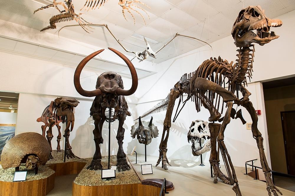
The Geology Museum is free and open to the public and is conveniently located near the heart of campus. A visit to the Geology Museum at the University of Wisconsin in Madison allows you to see and touch some of the oldest rock on Earth as well as explore a model of a Wisconsin cave. Take the geologic knowledge you gained from the museum over to Cave of the Mounds and see first hand a cave developed in the Driftless Area. Small enough to visit in a morning or afternoon, the museum involves a self-guided journey through five different exhibits: rocks and minerals, fossils, dinosaurs, meteorites, and a fluorescent display. If you have a group of eight people or more, guided tours are available for $2 each (call ahead). Smaller kids will be able to enjoy a replica of a cave and touching anything not encased in a formal display.
Any fees?: Yes; Guided tours for groups of 8+ for $2/person
Accessible?: Yes
Dog Friendly?: No
Difficulty: Moderate/Difficult
More Info:
https://geoscience.wisc.edu/museum/
Cave of the Mounds
2975 Cave of the Mounds Road, Blue Mounds, WI 53517-0148
Coordinates: 43.01743910657792° N, -89.81570426954134° W
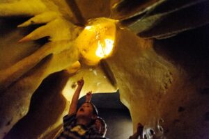
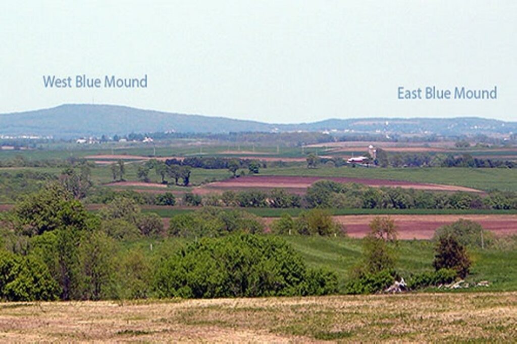
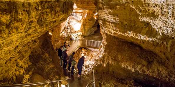
Cave of the Mounds takes its name from the Blue Mounds, two large hills which have long been Wisconsin landmark features. The West Mound, at 1716 feet, is the highest point in Southern Wisconsin; the East Mound reaches 1489 feet. Cave of the Mounds lies under the southern slope of the East Mound. Commonly referred to as the “jewel box” of America’s major caves for the variety and delicacy of its formations, Cave of the Mounds is recognized by the Chicago Academy of Sciences as “the significant cave of the upper Midwest”.
A guided tour of the Cave takes visitors past a varied collection of colorful stalactites, stalagmites, columns and other formations. The main cavern began forming over a million years ago as acidic water dissolved the limestone bedrock far below the surface. As Cave of the Mounds staff like to point out, geologic time is mind-boggling. It is difficult to imagine the time it took for the large caverns to be dissolved within rock that is itself believed to be over 400 million years old! A lower meandering portion of the Cave was formed by the rushing water of an underground stream. The contrast between the chemical and mechanical processes of cave formation is one of the geologic lessons illustrated on The Cave Tour.
Tours are provided on a first come first served basis. Visitors should call or check their website for current conditions.
Any fees?: Yes
Accessible?: Yes (on grounds); No (in cave)
Dog Friendly?: No
Time to Complete: Approx. 1 hour (depending on tour)
Distance: 0.2 Miles
Difficulty: Easy
More Info:
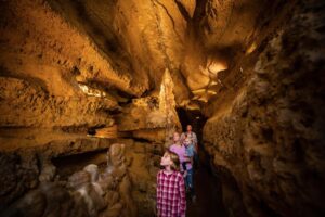
Crystal Cave
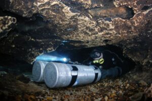
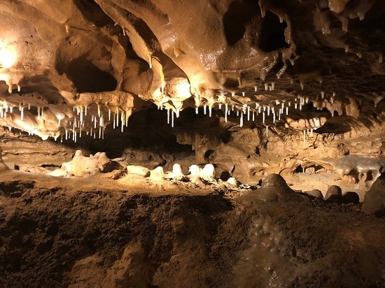
Discovered in 1881, Crystal Cave opened to the public in 1942, with some 4000 visitors showing up on opening weekend. Crystal Cave is Wisconsin’s longest, with about 4600 feet of passages. Located on the northern edge of the Driftless Area, Crystal Cave lies within dolomite (containing calcium and magnesium carbonate) and features iron ore, flint, and quartz crystals. Exhibits underground and on the property outside educate about geologic periods, as well as the fossils and bats of Crystal Cave. There is an 18 hole educational dinosaur minigolf course and gem panning. Ecology efforts extend to the surface, where a seven-acre field near the property entrance has been developed as a pollinator prairie in partnership with the Wisconsin DNR and U.S. Fish and Wildlife Service. Four electric vehicle charging stations available. Adventurous visitors can make reservations to take a three-hour wild cave trip through South Portal Cave.
Any fees?: Yes
Accessible?: No
Dog Friendly?: No
Time to Complete: 2 hours (3 hours for Wild Cave Tours)
Distance: 1/2 Mile
Difficulty: Moderate
More Info:
http://www.acoolcave.org
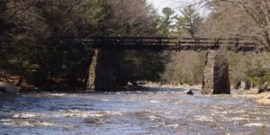
Dells of the Eau Claire
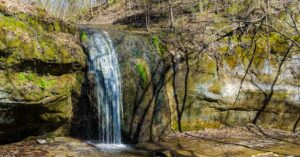
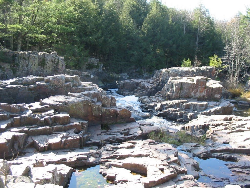
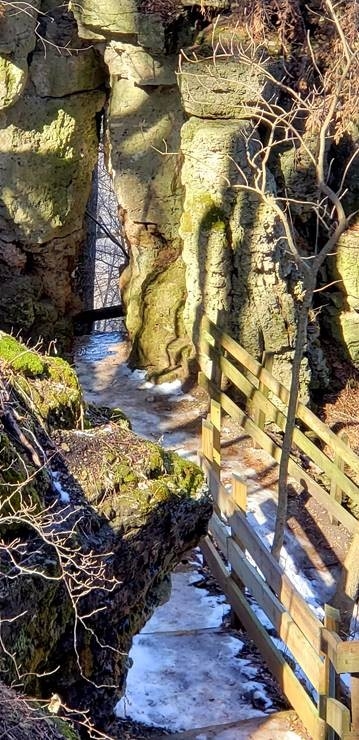
A three-mile segment of the National Scenic Ice Age Trail travels along the Eau Claire River and through Dells of the Eau Claire Marathon County Park. The small park contains the Wisconsin State Natural Area of the same name. The State Natural Area protects a rocky gorge with waterfalls and volcanic bedrock palisades tilted nearly vertical. The river cascades over outcrops of Precambrian-age rhyolite schist, which splits along its cleavage planes to develop multiple stream terraces. The river ledges attract visitors each summer, as do campsites and a swimming area above a small dam. The water current here has also created several potholes. The Walking Bridge above the dells and the High Bridge below the dells, combined with the Ice Age and park trails, provide complete vistas of the gorge.
Any fees?: No
Accessible?: Yes
Dog Friendly?: Yes (on the trails), No (on the beach)
Time to Complete: 1 hour
Distance: Less than 1 Mile
Difficulty: Easy
More Info:
https://dnr.wi.gov/topic/Lands/naturalareas/index.asp?SNA=109
Governor Dodge State Park
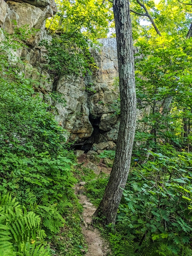
Governor Dodge State Park’s 450-million-year-old sandstone bluffs recall the period when vast, warm seas covered the region, depositing layers of sand, then retreating and returning again and again. Later, wind and water carved the park’s ravines and valleys. Excavations have revealed winter camps established by prehistoric peoples in the sandstone caves and overhangs as much as eight millennia ago. In particular, archaeological investigations at Deer Cove Rock Shelter evidenced early inhabitants. Artifacts, such as projectile points, scrapers, and choppers, discovered in excavated layers were used by both Archaic (8000 to 500 B.C.) and Woodland (500 B.C. to 1600 A.D.) peoples. Two caves, formed in St. Peters sandstone, are accessible from the Meadow Valley Trail. Big Cave, also known as Thomas’ Cave, begins with a three-foot-high entrance and stooping passage leading to a circular, high-ceilinged room. The Small Cave lies beyond and above a rock shelter northeast of Twin Valley Campground. Gates have been installed at the entrances of both caves to protect hibernating bats from human disturbance in the off-season.
Any fees?: No (vehicle admission stickers are required)
Accessible?: No
Dog Friendly?: Yes
Time to Complete: 3/4 hour (to Small Cave from the park road), 1 hour (to Big Cave from Twin Valley Campground)
Distance: 2-5 Miles
Difficulty: Easy (bring a flashlight and watch for puddles in Big Cave)
More Info:
Cave Trail
This is a 1-mile extension of the Meadow Valley Trail. Take in eye-catching sights of Twin Valley Lake as you walk along a hilly trail that takes you near a large cave known by the locals as Thomas’ Cave. Follow the grey trail markers.
Accessible?: No
Dog Friendly?: Yes
Difficulty: Easy/Moderate
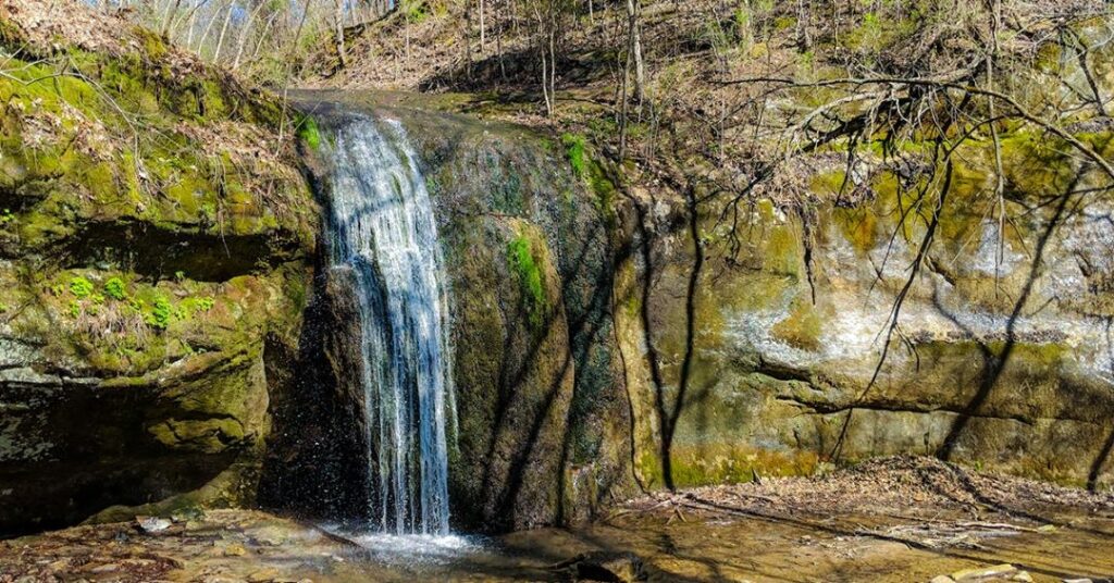
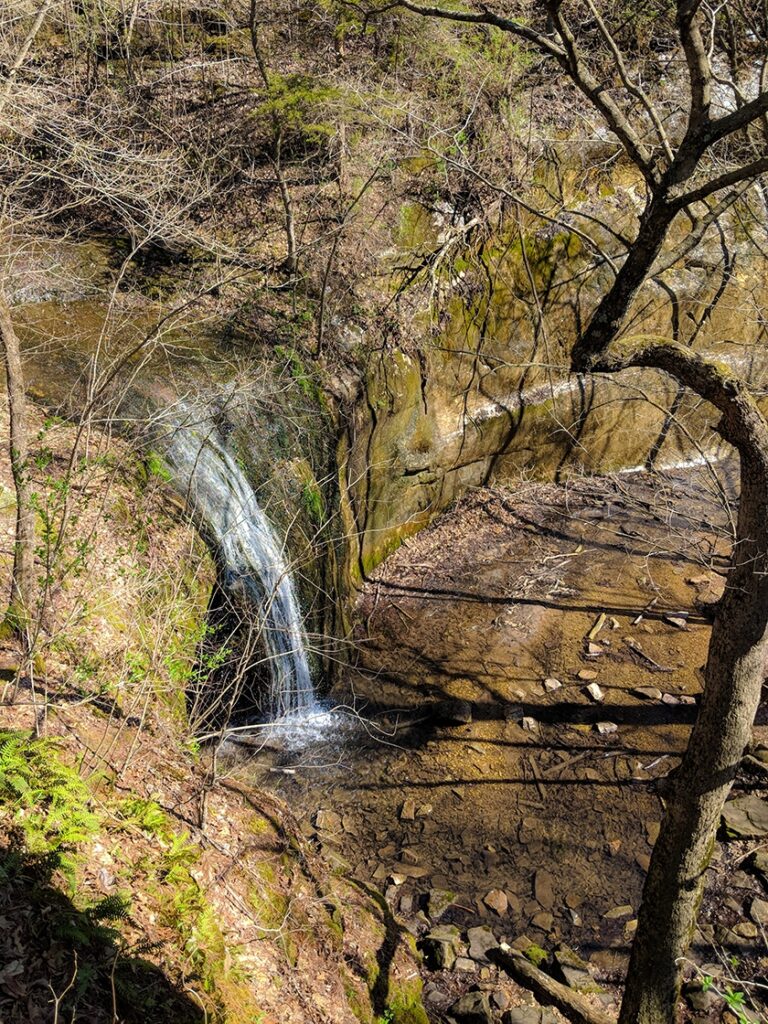
Stephen’s Fall Trail
This is a 0.5-mile picturesque trail that takes hikers past Stephens’ Falls, rock outcroppings and lush ferns as you walk beside a refreshing stream. There is a scenic overlook along a paved trail above the falls. Stone steps and uneven terrain will be encountered to gain access to the falls and the trail below. Follow the dark blue trail markers.
Accessible?: No
Dog Friendly?: Yes
Difficulty: Easy/Moderate
Lost Canyon Trail
This is a 3-mile loop trail that can be reached from the Stephens’ Falls area. The trail has several steep grades. You will encounter mostly wooded areas and will journey into the scenic Lost Canyon which is fed by Stephens’ Falls. Follow the orange trail markers.
Accessible?: No
Dog Friendly?: Yes
Difficulty: Moderate/Difficult
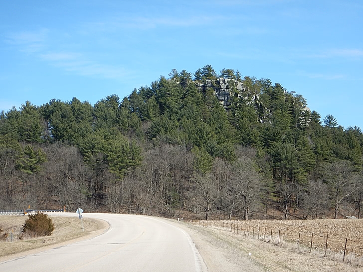
Castle Rock State Natural Area
From Lincoln Ave (US-18 E/US-61 S) in Fennimore go for 0.7 mi on 18. Turn left onto CR-Q and continue for approximately 8.9 miles. Castle Rock will be on the right with a pullout for several cars to park. An interpretive sign is located at the trailhead.
Coordinates: 43.0444336° N, -90.5204033° W
Castle Rock is visible from Hwy Q where you park just off the road to take the small dirt path up to the summit. This impressive geologic structure is composed primarily of sandstone. Its’ origins began sometime between 150 and 300 million years before present when Wisconsin was covered by a shallow sea. Deposited sediments compacting under their own weight developed the structure you see today.
Any fees?: No
Accessible?: No (Castle Rock can be seen from the road but the trail to the top is not accessible)
Dog Friendly?: Yes
More Info:
https://www.topozone.com/wisconsin/grant-wi/pillar/castle-rock-146/
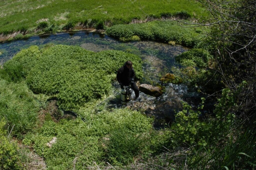
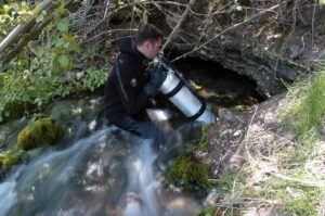
Castle Rock Spring
In the same area of the Castle Rock, Castle Rock Spring is located just north of Church Road on the right side of Cty Tk Q. Springs, a Driftless Area feature, provide the frigid water, ideal habitat for supporting trout. The river is a classic, cold water Driftless Area stream with a noteworthy trout fishery.
Any Fees?: No, it’s free!
Accessible?: No (Can be seen from the Road)
Dog Friendly?: Yes
Snow Bottom State Natural Area
Snow Bottom State Natural Area lies in the very heart of a diverse and spectacular Driftless Area landscape. It encompasses the most significant pine relicts in Wisconsin, as well as many other important and uncommon native plant communities including fen and springs, southern dry-mesic forest and oak woodland, riparian areas, and geological features. Located on the scattered sandstone outcrops are the pine relicts — isolated stands of white and red pine with occasional jack pine. To the detriment of the oaks, more mesophytic, shade-tolerant tree species are becoming established under current management practices and fire suppression. Also present is a diverse wetland of calcareous fen and springs that supports numerous calciphitic plants such as shrubby cinquefoil, grass-of-parnassus, Kalm’s lobelia, Ohio goldenrod, boneset, and swamp thistle. The Blue River flows north off the Military Ridge through Snow Bottom to the Wisconsin River. Snow Bottom is owned jointly by the DNR and private landowners and was designated a State Natural Area in 1992.
From the intersection of State Highway 18 and County G west of Montfort, go north on G 4.6 miles, then east on Bowers Road 1.6 miles to a small parking area just west of the Blue River. Walk north into the site. To access the western SNA parcel, from the intersection of County Q and G (located east of Castle Rock), go west on County Q 1.6 miles, then north and west on Cedar Rock Road about 0.4 miles. Walk north into the SNA. A paddle through Snow Bottom on the Blue River is rewarding, but possible only with small kayaks during periods of adequate river flow, usually in spring. The twisty, 5.5 mile section of river from the Bowers Road parking lot downstream to Shemak Road is wild in nature, offering wonderful Driftless Area scenery and excellent trout fishing.
Any fees?: No, it’s free!
Accessible?: No
Dog Friendly?: Yes
More Info:
https://dnr.wi.gov/topic/Lands/naturalareas/index.asp?SNA=262
Wyalusing State Park
Take U.S. 18 south from Prairie du Chien; turn right on County Highway C to County Highway X. Turn right on X and follow it to the park.
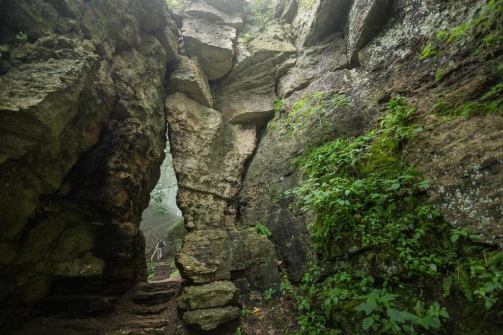
Situated above the confluence of the Wisconsin and Mississippi Rivers, the area that is now Wyalusing State Park was once a neutral ground where at least 14 Native American tribes lived or visited to trade. The 500-foot river bluffs have changed little since the tribes walked these lands. The openings of several small caves and rock shelters mark the bluffs, which are built of layers of dolomite, shale, and sandstone. The geologic sequence at Wyalusing is representative of the lower Ordovician carbonate/clastic sequence of the Driftless Area, from the contact with the underlying Jordan Sandstone at about river level through the Prairie du Chien dolostones up to the overlying St Peter Sandstone. Most of the karst is within the Prairie du Chien but is poorly exposed, bar a few small depressions and dry valleys. The caves are at the carbonate-sandstone contacts, Big and Little Sand Caves at the base and Pictured Rock at the top of the dolostones.
Any fees?: No (vehicle admission stickers are required)
Accessible?: Some scenery is accessible, many trails are not
Dog Friendly?: Yes
Time to Complete: 3/4 hour (to Small Cave from the park road), 1 hour (to Big Cave from Twin Valley Campground)
Distance: Less than 1 Mile – 2 Miles
Difficulty: Easy/Severe (Several trails are steep)
More Info:
http://dnr.wi.gov/topic/parks/name/wyalusing/
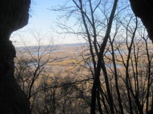
Bluff Trail
Take U.S. 18 south from Prairie du Chien; turn right on County Highway C to County Highway X. Turn right on X and follow it to the park.
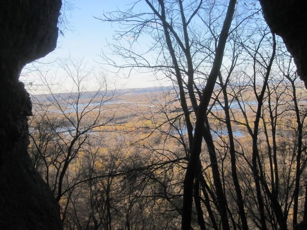
The hike to Treasure Cave begins at Point Lookout and heads down the Bluff Trail and through the keyhole—a narrow passage in a limestone outcrop. The small cave offers passage to a rock-framed window looking out on the Wisconsin River and two small rooms.
Any fees?: No (Vehicle Admission Sticker required)
Accessible?: No
Dog Friendly?: Yes
Distance: 0.9 Miles
Difficulty: Easy
More Info:
http://dnr.wi.gov/topic/parks/name/wyalusing/
Sand Cave Trail
Take U.S. 18 south from Prairie du Chien; turn right on County Highway C to County Highway X. Turn right on X and follow it to the park.
Big Sand Cave, Little Sand Cave, and Pictured Rock Cave are sandstone rock shelters . Little Sand Cave and Pictured Rock Cave feature small waterfalls that feed streams at their base. Black Thunder Point, located between the two caves offers an excellent view of the Wisconsin River.
Accessible?: No
Dog Friendly?: Yes
Distance: 1.6 Miles
Difficulty: Easy/Moderate
More Info:
http://dnr.wi.gov/topic/parks/name/wyalusing/
Mississippi Ridge Trail
Take U.S. 18 south from Prairie du Chien; turn right on County Highway C to County Highway X. Turn right on X and follow it to the park.
Mississippi Ridge trail starts at Homestead Picnic Shelter (parking available), crosses Cathedral Tree Drive and runs parallel to it until Henneger Point Picnic Area. The trail follows the bluff along the Mississippi River, ending at Henneger Point Picnic Area. An excellent view of the Mississippi River is available from Henneger Point. Bicyclists are welcome to bike the return trip back to Homestead Picnic Shelter via Cathedral Tree Drive.
Any fees?: No (vehicle admission stickers are required)
Accessible?: No
Dog Friendly?: Yes
Distance: 1.8 Miles
Difficulty: Easy/Severe (Several trails are steep)
More Info:
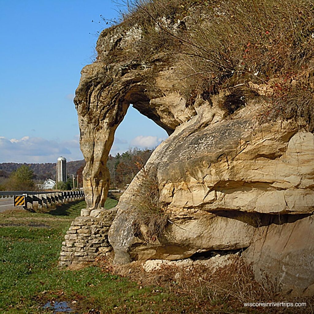
Elephant Trunk Rock
Hwy 58, Neptune, WI
From US 14 take Hwy 58 north around seven miles. The Rock is on Hwy 58, about 1.5 miles north of the right-hand intersection of Hwy N, between Devine Lane and Jaquish Hollow Rd.
Coordinates: 43.36527787226514° N, -90.26560919118123° W
Elephant Trunk Rock is located in a valley carved out by Willow Creek and its tributaries and is one of the most well-known rock outcroppings in the county. Elephant Trunk Rock was not always known by that name. An article in the ”Richland Democrat” from 1935 quotes the following told by a pioneer settler of the county that in a very early date it was called “The Devils Hitching Post.” “Children were told that when there was a death in the community, a man on a black horse tied his mount there and wandered over the hills and valleys, bringing the death angel. Tradition says a man once saw the horse tied there and approached to investigate. The horse seemed friendly and the stranger advanced to inspect and admire the animal, when a man appeared above on the cliff and the horse turned and kicked, striking the investigator and bringing death.
Such is the story told by mothers of the Devil’s Hitching Post some eighty years ago to their children.” Elephant Trunk Rock’s existence was threatened in 1923 when the owner, Peter Ruetten, was taken to court to argue the rock should be blasted out of the way in order to straighten the road, then a rutted, winding dirt road. A newspaper report of that time stated the argument was that “the shortest distance between two points is a straight line, and that all roads should be that shortest distance.” The article went on to say, “Transforming the crooked, sandy road, which curved between and around the interfering rocks, into a straight well-graded turnpike, was an accomplishment everyone approved until Elephant Trunk Rock was approached. When it became known it was the next obstacle to be removed, all residents in the vicinity rose against the plan. However, it was reported “Blasting was begun. A portion of the rock crumbled before agitation become so violent that the blasting was ordered to be delayed.” The article continued, “ At last so much pressure was brought to bear that it was carried to the state highway commission which ordered Elephant Trunk Rock should remain. A sign bearing the name of the rock was planted near its base.”
Any fees?: No, it’s free!
Accessible?: Can be seen from the pullout.
Dog Friendly?: Yes
More Info:
http://dnr.wi.gov/topic/parks/name/wyalusing/
https://ci.richland-center.wi.us/wp-content/uploads/2014/03/Elephant-Trunk-Rock.pdf
Lower Wisconsin River Road – Scenic Byway 60
(From Ithaca) Take Highway 58 south 4 miles to Highway 14 south. Turn south (left) on Highway 14 for 6 miles to Scenic Byway 60 and turn right. At this point the Scenic Byway 60 follows the graceful curves of the Lower Wisconsin River.
From either Wyalusing State Park or Elephant Rock in Ithaca, Wisconsin, the Lower Wisconsin Scenic Byway connects the two sites but are separated by 62 miles of Driftless Area scenery.
Any fees?: No, it’s free!
Accessible?: Yes
Dog Friendly?: Yes
More Info:
https://sites.google.com/site/lowerwisconsinriverroad/
https://www.facebook.com/Scenic60
http://www.scenic60.com
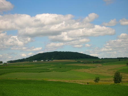
Belmont Mound State Park
Belmont Mound State Park, N Co Rd G, Platteville, WI 53818
Belmont Mound is one of several Driftless Area remnants that retain a top geologic layer of Niagara dolomite (limestone), along with Blue and Platte mounds. This dolomite formed during the Silurian Period some 430 million years ago. Beneath the Niagara dolomite lay bands of shale, limestone, and sandstone formed during the Ordovician Period some 470 million years ago; below these layers are blankets dating to the Cambrian and pre-Cambrian periods more than 500 million years ago. At the bottom is granite bedrock. The sandstones and limestones were deposited as inland seas covered and retreated from this region over the millennia. During the last 400 million years, erosion has carved this area, removing most rock layers, except for these mound remnants, still capped with the hard Niagara dolomite. The Niagara dolomite extends along the escarpment in eastern Wisconsin northeast to Niagara Falls. Formations on the north slope of the mound include a 40-foot-wide “tabletop,” about 40 feet across and a “cave” passage through a large boulder. There is an old limestone quarry on the south side of the mound and the remains of likely kilns near the parking area.
The trails go around the base of the mound, through the center of the park and to a loop in the northeast corner of the park. The trails are mostly for hiking, but off-road bikes may also use the trails. The observation tower is closed.
Any fees?: No (vehicle admission stickers are required)
Accessible?: Yes
Dog Friendly?: Yes
Distance: 1 Mile (roundtrip)
Time to Complete: 1/2 hour
Difficulty: Easy
More Info:
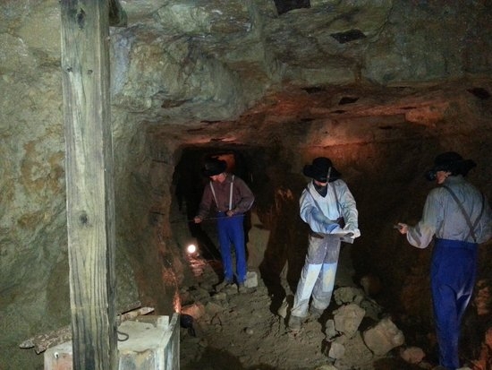
The Mining and Rollo Jamison Museum
405 East Main Street, P.O. Box 780 Platteville, WI 53818
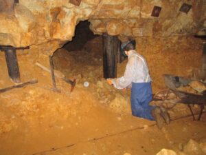
Exhibits in the Mining Museum building trace the development of lead and zinc mining in the Upper Mississippi Valley Lead and Zinc District from its beginnings in the 1820s until active mining ceased in 1979. Through dioramas, photographs, maps, and artifacts you will learn how lead and zinc were mined and processed into useful items of everyday life.
Exhibits in the Rollo Jamison galleries explore the personal collection of Rollo Jamison. Rollo Jamison, born in Beetown, Wisconsin in 1899, started collecting arrowheads on his family’s farm. This was just the beginning of his life-long interest in history and the objects used by people in their everyday lives. Rollo’s collection grew over the years, representing the unique history of Southwest Wisconsin. Your tour will take you back to the turn of the 20th century for a look at what life was like in Platteville and southwest Wisconsin.
More than 150 years ago Lorenzo Bevans struck it rich just a few yards from the museum back door. As you walk down the 90-step incline into the 1845 Bevans Mine, your senses will be alive as the temperature and humidity levels change. A tour of the mine takes you through over 100 years of local lead and zinc mining history. A visit to the headframe shows how ore was hoisted to the surface and hand-sorted.
Any fees?: Yes (tour fees apply)
Accessible?: No
Dog Friendly?: No
More Info:
https://mining.jamison.museum/